Our two foresails can be rolled in or out depending on the strength of the wind. More wind needs less sail so as the wind increases we can roll more foresail away and thus keep everything under control.
The mainsail needs to be lowered to reduce its size. This is called reefing and initially appears a little more complicated. Basically you have reefing lines that you use to pull a part of the sail down and then to keep them tightened down. The methodic is:
turn up wind to take the air out of the sail,
take up the weight of the sail and boom on the topping lift – line specially for this,
release the downhaul – line that pulls the main sail down,
pull in reefing line while gently releasing main halyard – the line that pulls the mainsail up,
release the topping lift,
re-tension the downhaul,
turn back downwind.
It sounds like a lot to do but we can now have a reef in a few minutes after deciding we need one. This is however definitely a case of “practice makes perfect” and we have now have plenty of practice.
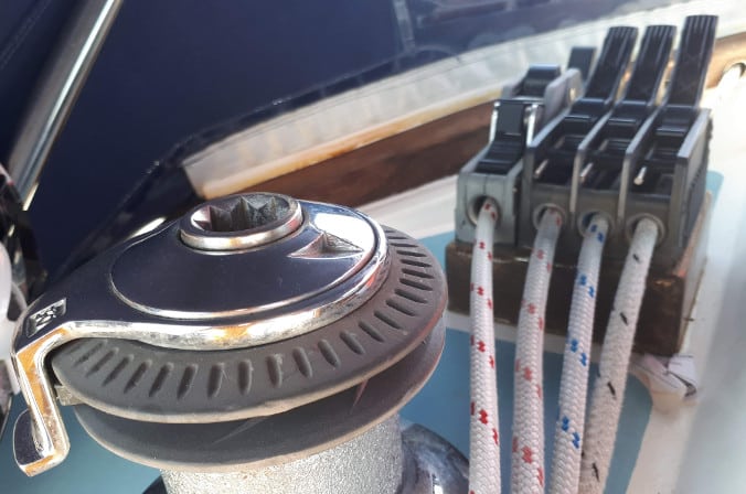
reefing lines and the downhaul
While crossing the Bay of Biscay we broke the first reefing line. It was already damaged and Heidi is really strong 🙂 In La Coruna we bought a new line and yesterday we replaced it. Our first reef is a “one line reef” which means you only pull on one line and it cleverly pulls down on both ends of the sail at once. That sounds simple but makes the actual mechanics much more complicated. The line runs backwards and forwards and round pulley after pulley. Trying to get the new line in without losing the ends or breaking anything was a real challenge and Neill needed a piece of chocolate to recover once it was done.
But today, when the wind got up, everything worked perfectly.
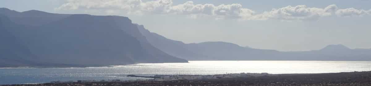
After a few nights at anchor in Cadeira we motored back out into the Atlantic, switched the engine off and waited for wind. And waited. And waited. A little further out another boat also sat rocking in the swell. A few boats motored past and Max was concerned they would consider us abandoned – bobbing on the ocean and gently rotating. A few hours later we had achieved 0.8 miles in the wrong direction. Just as we were despairing, the wind appeared exactly from the right direction, quickly picked up and pushed us along the coast to La Coruna. The first thing you notice is a huge lighthouse in front of the backdrop of a big city. The lighthouse was originally built by the Romans and is, in its modern form, impossible to miss. We avoided a fishing boat and tanker and then anchored off a beach opposite the city hidden from wind and swell by a headland.
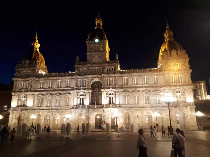
La Coruna
The next day we contacted the marina on the VHF radio and asked if they had a berth for us. “No problem! Go to pontoon 2 and I’ll meet you there.” We navigated to pontoon 2 and there was no one to be seen so we slotted in to an empty berth and got back on the radio. “Yes. Berth 232 is good.” The crew tied up, laid the electrics and got everything set for the marina while the skipper went to the office. “What? You are in berth 232 on pontoon 2? Why? That is not good!” I explained that we had followed his instructions and he explained that he doesn’t understand English. In the afternoon we discovered that today was Saturday and everything would be open on Monday so we had a good excuse to stay two nights and cycle on Sunday. In the evening Max found a brilliant restaurant in TripAdvisor with great food and a fantastic waitress. We enjoyed a fantastic meal. Despite the overcast skies and on and off drizzle on Sunday, Heidi and Neill cycled over 50 kilometers through the surrounding countryside. We were never higher than 250 meters above sea level but still managed 1000 meters of climbing. And a lot of the route was trails, forest roads or cycle paths. A brilliant route – thanks GPSies. We were attacked by brambles and gorse, rained on and felt like we were in a tropical rainforest. It was great fun but eventually we just took the road straight back to the boat and a much needed warm shower. One thing we now no for sure – nothing is open on Sunday. Even the motorway was carless. The track is at https://www.gpsies.com/map.do?fileId=ozpgmmuamxnvnhgs
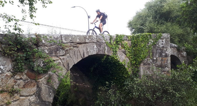
Old bridge in Galicia
On Monday Spain reopened so we bought a new reefing line, food, diesel and gas. We charged up everything that we own and filled up with water and then returned to our beach across the bay and back to anchor. Coffee with Baileys, homemade cheeseburgers and potato salad were the perfect end to the day.
We sailed from Morlaix and then around the coast of Brittany finally leaving the Channel and entering the Atlantic. Now it was time to wait for a suitable weather window to cross the notorious Bay of Biscay. As we sailed past Brest it was obvious that the time to go was “Now”. We were surrounded by boats with spinnakers flying all heading south. A look at the weather forecasts confirmed that we had three to four days of perfect conditions ahead of us.
We put in to Sainte Evette to fill up with water and food, and drink a last cup of french Cappuccino. They had a Lidl supermarket outside of town so we had a forty minute walk there and back to do the shopping. The walk there was fun but, fully packed, we were happy when we reached the harbour on the way back.
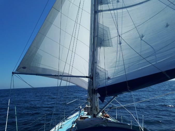
In the afternoon we weighed anchor and headed south on a bearing of 216° heading for the north west corner of Spain. The wind was behind us, there was little swell and we were making over five knots. 300 miles felt like a long way but we were optimistic that “after three times sleeping” we should be seeing spanish hills and forests.
Downwind sailing in Bay of Biscay
At some point a pod of dolphins turned up to play. They were all around us and surfing the surrounding waves. One time we were looking straight at four dolphins looking out of a wave next to us and probably wondering what we were doing in the middle of their ocean.
Heidi took the first shift, I took over in the middle of the night and Max sailed us in to the dawn. At some time we sailed into fog. No stars, no moon and glad that there was so little shipping in the Bay.
During the day the fog burnt off and the sun came out. We turned down wind, poled out the Genoa and sailed straight down wind seeing only one warship in the distance and a sail in the evening. So much space and no one but us and a few dolphins .
By midnight the wind had picked up and we were still sailing downwind. A gust from the side backwinded the mainsail and the windvane lost control. “All hands on deck!” even Heidi who had been in bed for about five minutes. We stowed the Genoa and reefed the mainsail during which we managed to rip the first reefs (already damaged) line. No problem – we have two more reefs so we put in the second reef.
On our second full day there was less sun but still plenty of wind so we let out a little genoa and once again were making good speed straight downwind. A second day running we achieved over one hundred miles in 24 hours. At one point the windvane broke but we are now experts at running repairs and quickly had “her” back up and running. In the morning we saw a japanese tanker and in the afternoon a bulk carrier. We called the carrier on the radio and asked for a weather update. “Force 4 from the north” was the short east European sounding answer which was exactly what we wanted to hear. Max was still trailing a fishing line behind us and once again catching nothing. Heidi was either immersed in her book or creating great food – no cruise ship can compete with our food. And Neill was planning or sleeping.
Dawn in the Bay of Biscay
The east European weather forecast was a lie. The wind turned steadily from the west driving us in to the bay. Before dark we set both sails to the port side and then increasingly turned up wind during the night. By dawn we were hard on the wind and even then we couldn’t round the last headland. Neill tacked away from the coast, left instructions for a later tack and went to sleep leaving Heidi and Max to get us to the port. After 325 miles we were just off Ria de Cadeira when the wind dropped completely so we motored the last mile in to the bay and anchored in Spain three days and one and a half hours after leaving Brittany.
After our long and somewhat circuitous journey from Guernsey, we were anchored in a bay at the mouth of a river next to a fort built to keep the marauding English away. The next morning there was no wind and none expected that day so we decided to take a tour up river. The river is tidal but at high tide there was going to be plenty of water so we left early and followed the rising water upstream.
To begin with we passed a small fishing village and it was immediately obvious we were in France – you don’t see louvred shutters in England. Then the river became much narrower and we were sailing along with cars passing us on the roads on each side. We waved to the occasional cyclists and they returned our greeting. There is something very surreal about travelling on a 36 foot sailing yacht through the middle of the french landscape waving to passers by. A few times we nearly touched the mud below us but with a rising tide we were all in chilled mode.
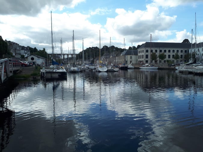
Morlaix
We passed under a huge bridge that carried the motorway over us and then rounded a bend and saw the lock in to the town harbour ahead. We began preparing to tie up to the chains hung on the wall but the harbourmaster came jogging out to meet us and told us we could enter the lock immediately. Luckily his English was better than our French so he was able to explain where we should berth and give us a little map so that we couldn’t get lost. With the exception of Porthmadog he was the only harbourmaster we have met to be so well organised. Must be a celtic trait.
The harbour is in the historic city of Morlaix so after mooring we set off to explore the old town center and the huge viaduct that carries the TGV trains over the valley. Once we had looked at the old houses faced with stone shingles, we did some serious price comparing in the local supermarkets. We were so successful that we could even afford vanilla ice doused in Baileys (actually cheap substitute Baileys – we are unemployed 🙂
Having spent a morning being tourists we buckled down to some serious cleaning, deck scrubbing and anchor chain remarking (thanks Max) before rewarding ourselves with a bottle of wine with dinner and another glass at the harbour side bar.
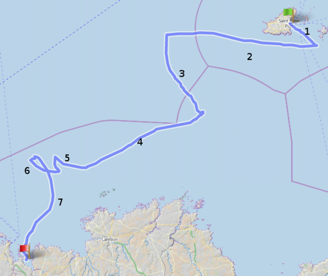
From St. Peter Port (on the Island of Guernsey to Morlaix (in Brittany, France) it is only 72 nautical miles as the crow flies. Unfortunately we are in a boat so have to sail around rocks and islands so that increase the distance to about 78 nm. Even more unfortunately we were in a sailing boat and had the wind against us almost all the way and a tide against us six hours in 12. The result was that we sailed 136 nm!
Guernsey to Morlaix
Leaving the marina, we had to sail almost back to Sark (1) against the tide before we could tack back south of Guernsey. A friendly tide took us well out to the west (2) and would have been perfect – if we had of been heading for England. But we were heading for France so we turned south (3). The tide was pushing us back East and when the wind dropped we just began to float back to where we had come from – and towards a reef. Some time in the night we switched the motor on and motored across the becalmed, black sea (4). In the early hours of the morning we felt a breath of wind so switched the motor off and started to sail (5). We were heading out to sea again but we were sailing and bad sailing is always better than good motoring.
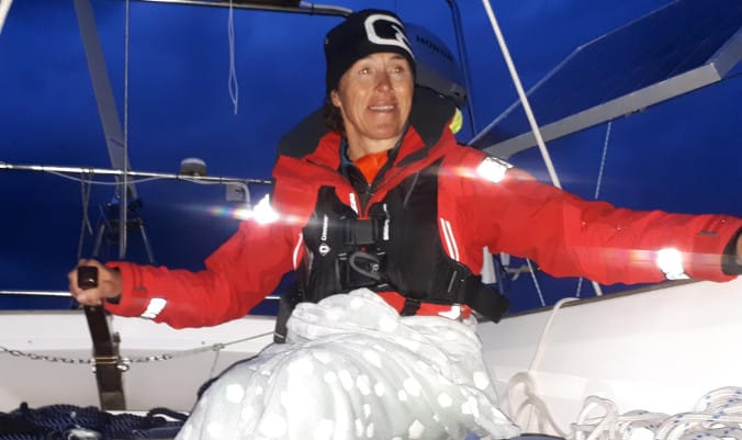
Then things got crazy. Boat sailed, Wind dropped or changed direction. Boat stopped or went backwards. Try new tack and do it all again (6). At least by now we had a full moon to see that we were going nowhere. And on Max’s watch we had a “close encounter” with a racing yacht.
Midnight and the windvane steering is playing up (again)
In the early morning we tacked again turning south east and suddenly everything worked magically (7). The wind slowly veered west and the current picked up moving us west. With a tiny bit of sail trimming we sailed past the sand banks, through the reefs and directly in to Morlaix Bay and the river mouth where we anchored after an adventurous 30 hour passage.
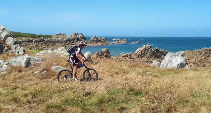
We are sailors but we are also mountain bikers so if we can’t sail, we are just as happy to go biking. We are currently in Guernsey and the weather forecast is talking about gusts up to 40 knots and three meter high waves so we – sensibly – decided to go for a bike ride. We found a GPS route around the north of the Island so, after unpacking and folding out our bikes, we set off to follow it.
Cycling on Guernsey
It became obvious that the route was suitable for road bikes so we started to add in our own little diversions always following the coast as closely as possible. This was much more fun and allowed us to see much more rocky coastline, a few forts from Napoleonic times and lots of German bunkers from WW2.
The sections of deep soft sand and the head on storm also increased the training effect considerably. It is not often that you need to tack in to the wind on a bike.
Guernsey seashore
On the far side of the Island we watched motorbikes and buggies racing on the exposed sand at low tide. There was some serious drifting going on and we saw one or two tumbles. It was obvious why there were two ambulances on standby.
Bikes are the perfect way to see the Island. Almost all our route was inaccesible to cars and it was much too far to walk in an afternoon. Once again we were so thankful to have our bikes with us.
Having reached Chichester and spent a fun and productive week with my sister it was now time to head further South. We began by using the tide to sail back through the Solent to Yarmouth where we anchored just before dark to wait for the next mornings tide. We anchored just outside a tidal rip and Max, after many nights of bad anchoring experience in Australia, was very unhappy and threatened to stay up to watch the tide turn at 02:00. We know our Rocna and we all slept well (even Max) to find the yacht still at anchor the next morning.
When you cross the Channel you have to take account of the tides which begin by pushing you one way and then the other. I had fun adding up the tides for each hour of our crossing and then adding an offset to arrive up tide of Cherbourg.
To begin with there was no wind so we motored and Neill slept leaving Heidi and Max (our new crew member) to avoid the large vessels that populate this busy sea route. Max had his drone on-board and was willing to risk a start (and landing) while out at sea which resulted in this spectacular video.
By mid channel we were well off the “direct route” having drifted with the tide as expected. The trick here is to keep your cool and believe that on the second part of the journey you are going to be pushed back on to course.
Later the wind came up and we were able to sail our planned course. As France came in to view we received the confirmation that we were going to take the tide straight in to Cherbourg harbour. I love it when a plan works out and the wind and tides take you where you want to go.
After sailing along the south coast of England and through the Solent, we finally reached the marina at Birdham Pool where we moored the boat and left her for a weeks holiday on dry land at my sister’s house. Here we were finally reunited with our foldable mountain bikes which had been in England having carrying bags sewed up. The first day we used the bikes to cycle back to the boat to meet some one bringing us spare parts and advice for the windvane. The route was easy – cycle to the Chichester canal and follow it to the sea. Unfortunately when we reached the canal I started following it the wrong way so we cycled to Chichester before I realised my mistake and we turned round. We were both so happy to be back on bikes that we happily ignored the brambles that reached out along the towpath to cut us. Heidi commented that it was great that we still knew how to get out of our click shoes and that the only thing that really needed more training was our backsides.
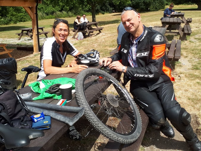
The friendly Mountain-/motorbiker
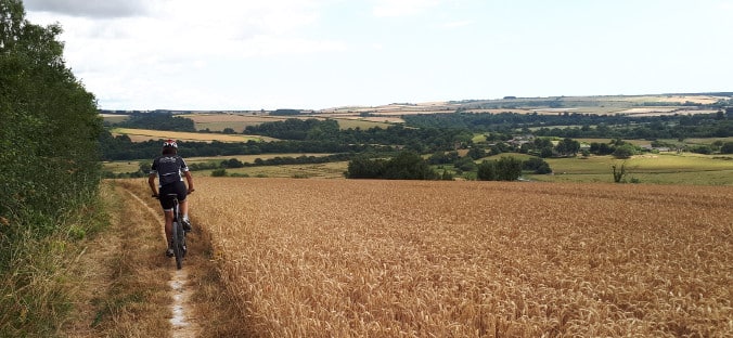
We downloade our route to Arundel from GPSies.com. This is a fantastic resource which allows us to find great cycle routes whenever we arrive in a new location. Search for the area you are in, select MTB as type of route, upload to GPS and you are off. This route was from Zanzubaa.
The next day we planned a more ambitious ride into the “Sussex Mountains”. This was a route we found on GPSies.com and had obviously been uploaded by a local as it was a non stop collection of hidden byways and overgrown footpaths. Once we got up in to the “mountains” (150m above sea level) and amongst the grazing sheep, Heidi fell over without getting out of the click shoe and, a little later, she got a puncture. No problem. Took a photo, removed inner tube, removed 20mm long thorn and …. realised we had a pump with us that wouldn’t work. There was nothing for it; we had to continue with Heidi pushing. Later we met a mountainbiker with a pump so pumped up the tyre and … the valve was broken and wouldn’t hold the air. A quick cycle and then back to pushing. When we reached the road we mended the puncture and were then saved by a really friendly motor-/mountainbiker who blew it up with a compressed air cartridge.
The friendly Mountain-/motorbiker
With a working bike we continued on to Arundel being ripped by brambles and gorse or stung by nettles. The English countryside can be very violent. In Arundel we photographed the castle and rode through town before disappearing back in to the undergrowth for the ride on back to my sister’s. Only about a kilometer before our destination I picked up the next thorn and ended up pushing. A brilliant ride on a great route. We love being bikers again. Our route is at https://www.gpsies.com/map.do?fileId=iithdmbcgbonqhkd
Portland Bill is a spit of land that protrudes out in to the English Channel. It is legendary for fast tides and a huge tidal race that apparently eats boats. The Channel Pilot writes “the most extended area of broken water in the English Channel, overshadowing even Barfleur, the madness of Ouessant and the race of Alderney. Quite substantial vessels drawn in to it have been known to vanish without trace.”
Another document claims that “half of all lifeboat rescues in the area are of vessels drawn in to the race.”
We had originally planned on passing the Bill a few days ago as we were out at sea heading East but the lack of wind and its direction stopped us reaching the tidal gate at slack tide so we diverted to Lyme Regis. The next morning we spoke with the harbourmaster and asked if Portland Bill was really a boat eating monster. He described it as the south coast sailors Cape Horn and said that with the actual wind and tide conditions it is no problem at slack tide. Continue reading “Portland Bill”