The last few miles

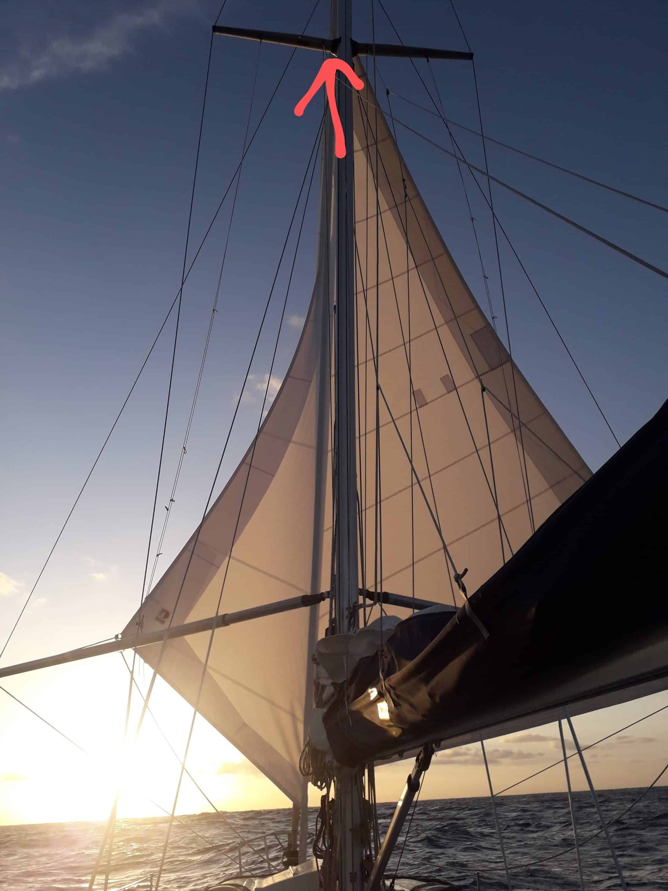
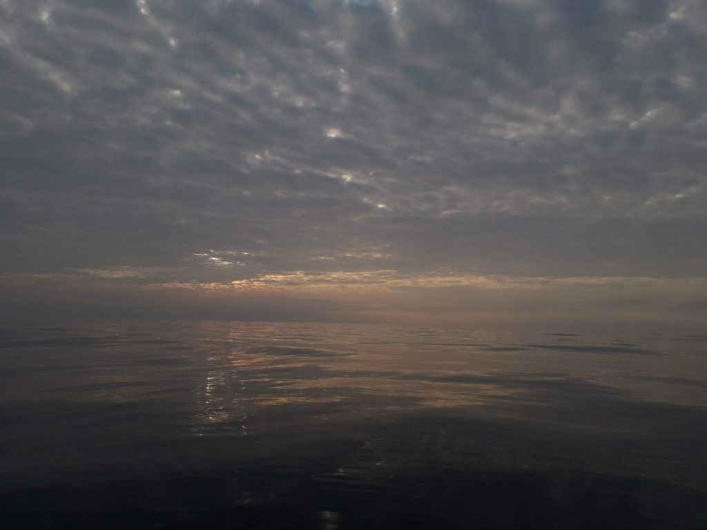
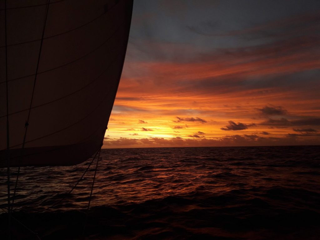
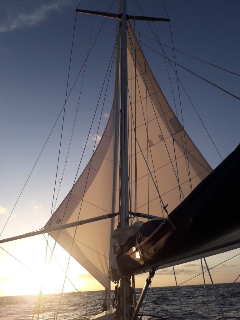
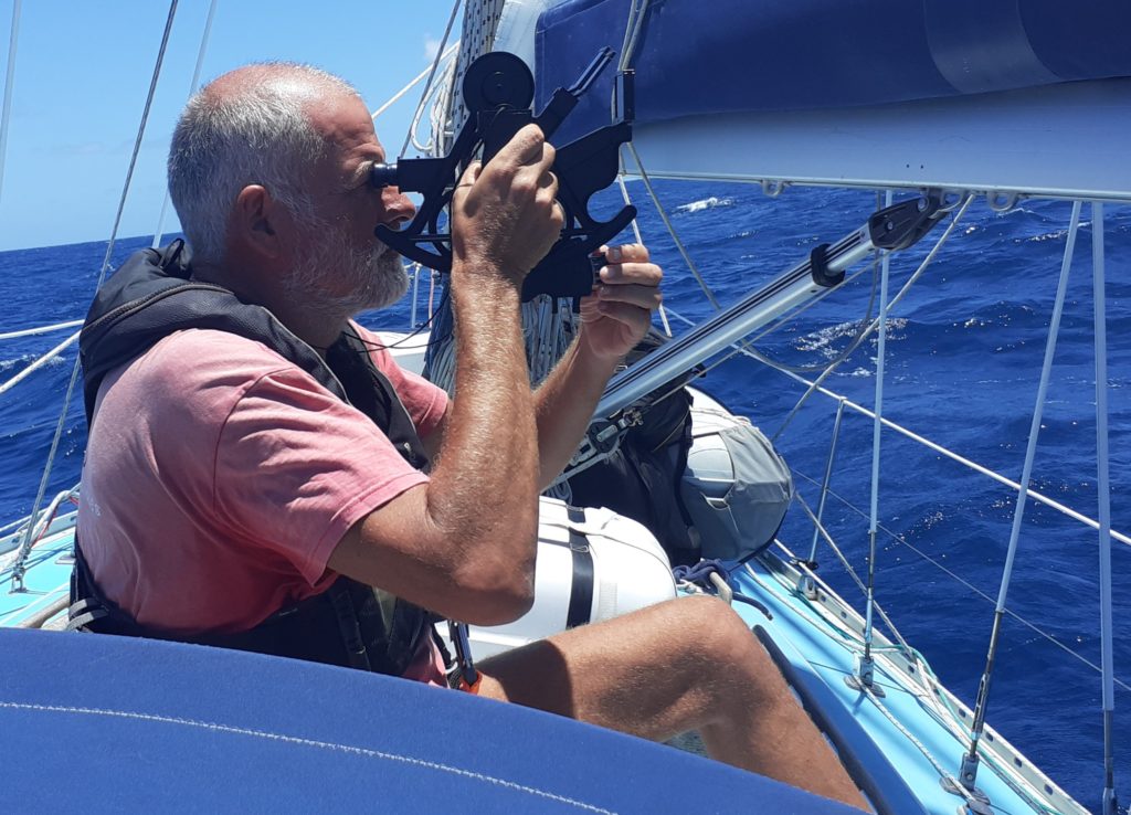
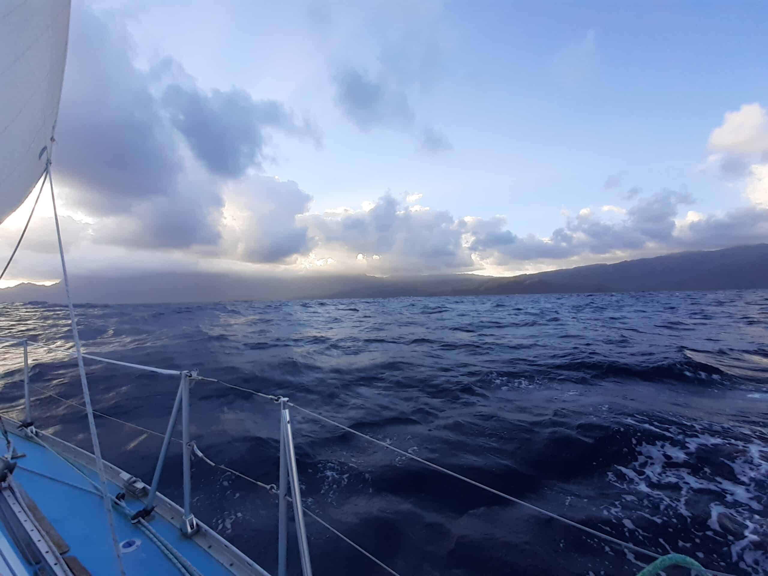
After 53 days at sea we finally sighted land. In the distance we could vaguely make out the south Pacific islands of Hiva Oa and Mohotani. Our navigation had worked, they were exactly where they should be. As the day continued we sailed between the islands and began a race – us and the wind against the setting sun. Each hour we recalculated average speed and distance to run and each time the result was the same – we may be there before dark. No way were we entering an unknown, badly lit, full harbour at night.

Hiva Oa to starboard

We prepared the stern anchor because all our information was that the bay at Atuona would be packed with boats stuck there by the Corona virus and, if we could find space, we would have to shoehorn ourselves in.

We called ahead on the VHF to try and finally get permission from the authorities to enter the country. But no one heard and no one answered.

Would there be any space? Would our depth sounder work after the Raymarine bus problems a month ago? Would we reach the bay before dark? Would we be spotted and turned away by the French navy? Would our engine work after seven weeks of inactivity?

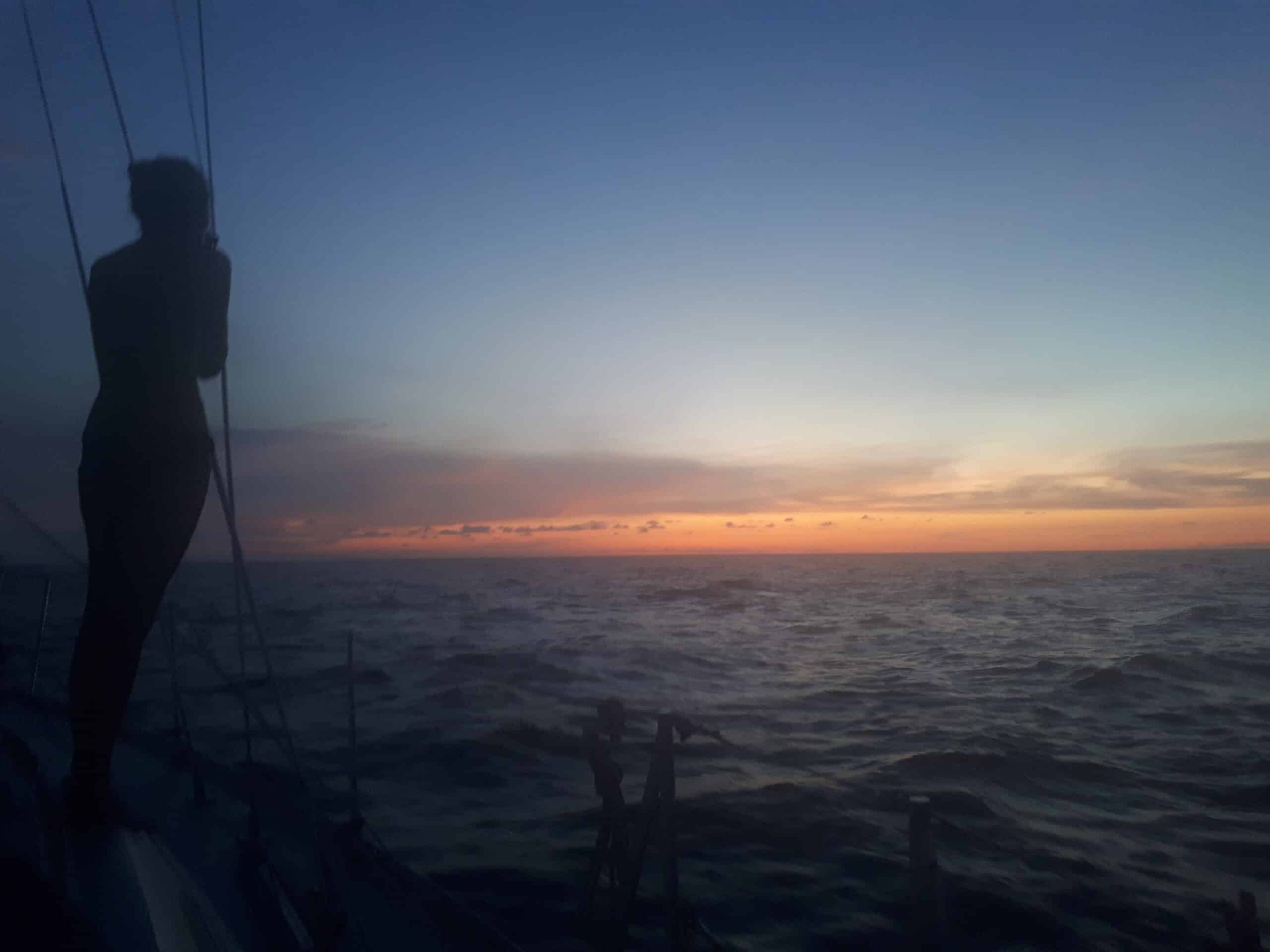
The sun cheated by setting an hour early behind a mountain and we retaliated by starting the engine for the last three miles – it worked after a bit of cranking. In the twilight we found the marker that shows the entrance to the bay – although the lights on it were not working – and headed towards the shore. Finally, and to our great relief, the depth gauge began to work. On the first boat we passed a lady ran to the bow to inform us that the inner bay was full but to anchor by the breakwater.

We dropped anchor and within minutes the new neighbours were there in their dinghy bringing us fresh fruit and assuring us the locals would let us stay whatever the central government said.

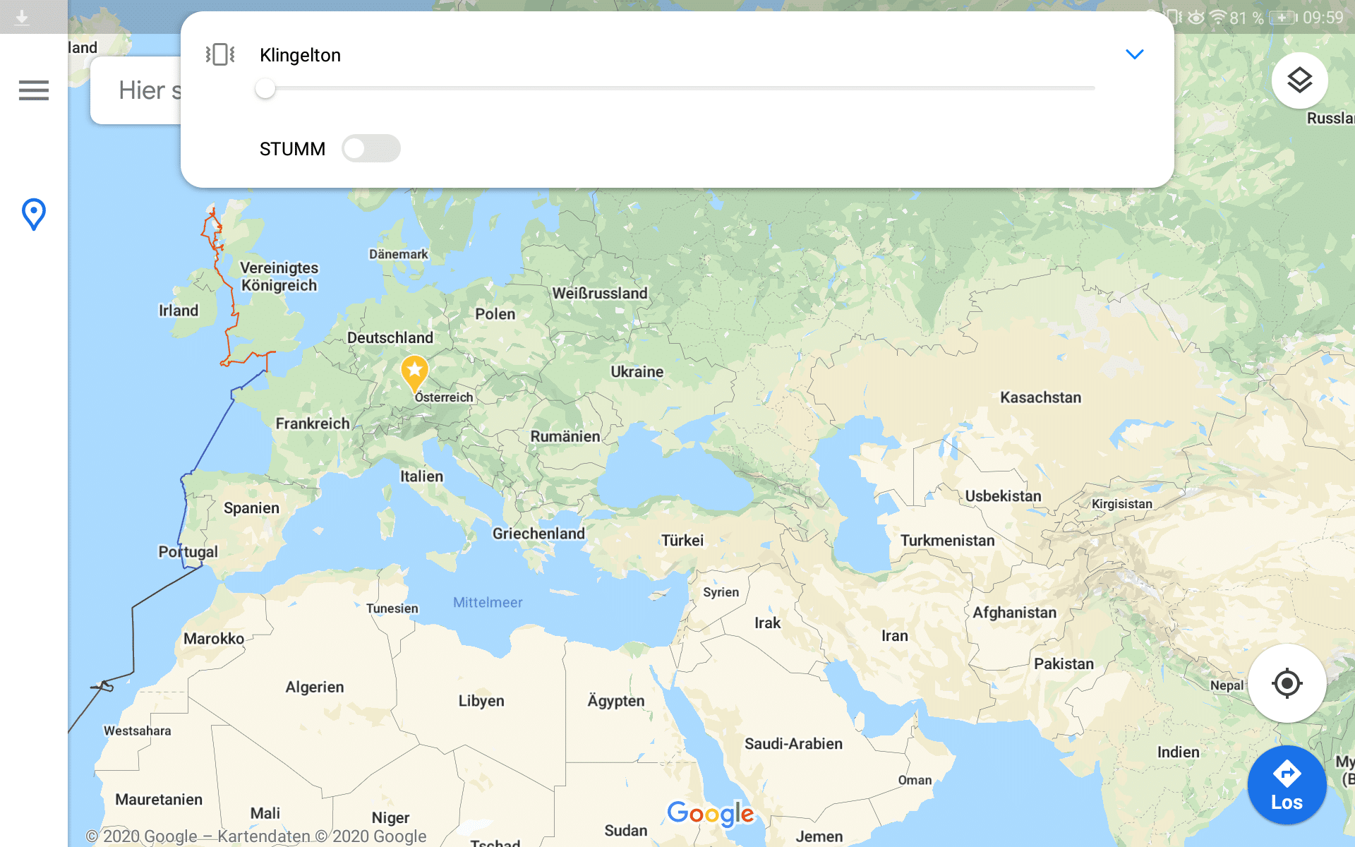
We had sailed 4035 miles across the Pacific and were excited at our new achievement but now we were relieved and happy just to be at anchor.

Last night at sea?

Tonight is our fifty third night at sea and it may be the last for this voyage.

We both find it hard to believe but maybe at first light tomorrow we will see the island of Hiva Oa before us. This has been our destination since we changed plan some 3000 miles ago. Back then it was so unimaginably far away and now it waits “just over the horizon”.

The last person we saw was a fisherman who begged food seven weeks ago. The last ship or vessel of any type was also six weeks ago. A few weeks ago we met a huge whale and there is always the occasional seabird or flying fish but basically we have been alone.

Maybe tomorrow we will see people or even talk to someone. Maybe smell vegetation or earth. And maybe sleep anchored to the seabed. Strange thoughts but we shall see.

Now we just enjoy another warm night under the well known stars by the light of a quarter moon.

Einen Monat auf dem Meer

Wir sind zu unserer längsten Reise aufgebrochen, 2300 Nautikel Miles zur Osterinsel. Wenn du so ca. 100 Nm \ Tag machst bist du in ca 25 bis 30 Tagen da 😊 doch wenn du schon für die ersten 600 Nm zwei Wochen brauchst, dann dauert es eben etwas länger 😁🤭🙈; und wenn dann noch sämtliche Länder wegen des Corona Virus ihre Grenzen schließen, dann hofft du darauf, irgendwann eine Insel zu finden wo du anlegen kannst. Gott sei Dank haben wir Lebensmittel für ca. Drei Monate eingekauft und dank unseres Wassermachers haben wir auch diesbezüglich keine Sorgen 👍. Aber ihr fragt euch sicher was macht man denn den ganzen Tag auf einem kleinen Boot 🤔 das muss doch stink langweilig sein. Ich kann euch versichern, dass ist es nicht 😀😀. Als wir über den Atlantik gesegelt sind haben wir 18 Tage gebraucht und davon haben wir neun Tage lang nichts an den Segeln verändert. Ganz anders hier im Pazifik, den ersten Tag haben wir die Segel gerieft weil wir zuviel Wind hatten ; die nächsten 13 Tage haben wir verzweifelt nach dem Passat Wind gesucht und alles mögliche mit den Segeln ausprobiert 🙈 Genoa gesetzt, Wind zu wenig wieder weg dann Parasailor gehisst doch bei Null Wind hilft auch der nix 😜 und so weiter und so weiter 😀😀. Ihr fragt euch warum schalten die denn nicht den Motor an, ganz einfach wir haben Diesel für ca. 40 Stunden und die schon am Anfang zu vergeuden macht keinen Sinn und außerdem sind wir ja ein Segelboot ⛵⛵. Aber glücklicherweise hat der Wettergott doch noch ein Einsehen mit uns und wir kommen jetzt gut voran 👍zwar nicht mit 100 Nm sondern nur um die 80 aber wir sind nach der letzten Zeit sehr bescheiden geworden und glücklich darüber vorwärts zu kommen.

Wir haben Zeit endlich unsere Radl Taschen zu nähen, unseren Regen Wasser Fänger zu designen und sonst noch ein wenig kreativ zu sein 😊. Natürlich bleiben auch kleine Reparaturen nicht aus, wie z.B ist die Leine an unserer Segeltasche vom Hauptsegel gerissen, nicht schlimm denn wir können es einfach mit einem Knoten reparieren – doch anschließend muß die Leine am Mast in ca. 11 Metern Höhe wieder befestigt werden. Eigentlich bin ich gern unser ‘Mastmonkey’ und hab voll Spaß gut gesichert am Mast rum zu klettern aber bei 15 Knoten Wind und zwei Metern Swell war es auch für mich eine Herausforderung. Ihr könnt es euch ungefähr so vorstellen, wie Maibaum klettern nur ca. 11 Meter und der Baum bewegt sich so ca. 20 Grad in alle Richtungen 🙄🙄. Nach 25 Minuten kraxeln war ich glücklicherweise wieder auf ‘festem’ Boden und total am Arsch 😏😣 mit zitternden Armen, Beinen und wackelnden Knien kam ich zurück ins Cockpit und war für den Rest des Tages einfach nur geschafft 🙈🙈.

Somit seht ihr, dass es alles andere als langweilig ist und in ca. 2000 Nm hoffen wird in den Marquesas an Land gehen zu dürfen 🙏🙏 also nochmal ca. 30 Tage oder so. 😊😊 Aber ich erzähl es euch wie lange es noch gedauert hat.

Signposts in the sky

Woken up in the night with a coffee by Heidi to start my shift. Half moon was about 40° above the horizon so the time was roughly two in the morning. The southern cross was off to port (left) so our course was west. The water could be heard running past the hull so we were making over three knots in the correct direction.

We have all sorts of electronic toys on board. With the magic of GPS, we can be sure of the time to the second, our speed to a tenth of a knot and our position to about three meters. Nice – but irrelevant. The moon, the stars and the sounds of the boat tell us all we really need to know.

Two years ago, the northern star – Polaris – was our guide. A quick glance at the big dipper showed us where it was and we knew our course “good enough”. But Polaris long ago disappeared below the northern horizon and now we have new friends – Kruz, Garkruz and Arkruz, three points of a cross and Kantaurus and Hadar pointing towards them. New stars above a new ocean guiding us on to new lands.

Endspurt

Wir sind jetzt 53 Tage unterwegs und haben die letzten 100 Nm angebrochen 🤭 eigentlich schon verrückt solange unterwegs zu sein. Um etwa eine Vorstellung zu haben, wie weit das ist es wäre von Schottland bis nach Nepal 🙄🙄. Wir haben uns ja auf etwa 30 Tage eingestellt und jetzt ist es eben fast doppelt so viel geworden 😀.

Verrückt ist aber schon, dass dieser riesige Pazifik so leer und einsam ist. Am 2. Tag haben uns Fischer um etwas zu essen gebeten und danach haben wir kein Boot mehr gesehen und auf der gesamten Strecke – ausgenommen neben den Galapagos Inseln – haben wir nur einen einzigen Wal gesehen . Der war dafür riesig 🙈 er hat Sprünge gemacht und wir waren einfach nur sprachlos. Mehr als ein WOW brachte keiner von uns zustande, ich stand auf unserer Artemis und sah dieses gigantische Wesen aus dem Wasser steigen und hab gehofft, dass er nicht aus Versehen bei uns an Bord landet 😀😀.

Und bald hoffentlich haben wir wieder festen Boden unter den Füßen 🤭bin schon neugierig auf die Insel und was uns dort erwartet. Quarantäne ja oder nein? Und wie es dann weiter geht ist auch noch unklar, denn Neuseeland überlegt wohl für ein Jahr die Grenzen zu schließen. Warten wir mal ab was geschieht und bald können wir auf jeden Fall “Land in Sicht” rufen 😀😀

Der riesige leere Pazifik

Morning wake up call

Another morning in the Pacific. Over three hundred miles from Peru and two hundred off the Galapagos Islands. The sky is blue, the water is blue and we are brown – and in my case naked. Heidi has a bikini on but there is a huge rip in the back. We are lounging in the cockpit drinking coffee. Only another two thousand miles to Easter Island and getting less each day.

Then the AIS alarm sounds and the display starts blinking. Something is going to hit us in three minutes. We scan the horizon frantically but it is empty. The alarm stops and the ghost ship disappears off the screen.

Barely have we sat down again and the alarm starts again. “HC-COA” is approaching at 80 knots and impact is imminent. We can see NOTHING! Heidi suggests a super fast submarine. I’m thinking cruise missile. We are both thinking “Shit!”

This is the helicopter that visited us.

And then Heidi spots a helicopter heading our way. I dive below to look for underpants. Keeping her bottom away from the helicopter, Heidi waves to the hovering pilots and they wave back. Then they are off again looking for some one else to terrify.

Südseeinseln oder ??

Wir treffen Vorbereitungen für unsere bislang längste Etappe von ca. 2300 Nautikel Miles zur Osterinsel und nach Pitcairn. Wir wollen wenn es irgendwie möglich ist unsere Fahrräder auf die Insel bekommen und um die Steinmändchen Radeln 😀😀 und auf den Spuren der “Meuterei auf der Baunty” wandeln. Unsere Freunde Wim und Elisabeth sind schon voraus und versorgen uns mit Informationen über Ankerplätze und vieles mehr. Die beiden haben dort furchtbar schlechtes Wetter und Stürme erlebt und waren dann froh, als es bei ihnen weiter ging. Aber bis wir dort angekommen ist das Wetter bestimmt gut und wir können an Land 👍gehen .

Doch dann holten auch uns die Folgen des Corona Virus ein, denn plötzlich schlossen sämtliche Staaten und Inseln ihre Grenzen🤔🤔. Was für uns bedeutet, daß wir nicht an Land gehen können 😥😥 also was machen wir jetzt??? Gut dass wir auf unserem Garmin Inreach (das ist ein GPS Gerät, auf dem wir auch im “nirgendwo” Nachrichten empfangen und senden können, das unsere Position angezeigt und wo uns unsere Wetter Melder Wetterberichte und Informationen zukommen lassen können ) auf unbegrenzte Menge an SMS gestellt haben. Denn jetzt müssen wir irgend ein Stück Erde finden dass uns erlaubt, an Land zu gehen 🙏.. Max, Neills Sohn hat sich gleich mit den verschiedenen Botschaften in Verbindung gesetzt und jetzt haben wir ein neues Ziel in Aussicht 😀😀 Wir segeln zu den Marquesas, was zu Französisch-Polynesien gehört und nur noch schlappe 1000 Nm weiter ist als zur Osterinsel. Nach unseren bisherigen Informationen haben wir dort eine Quarantäne Zeit von 14 Tagen, aber dann dürfen wir an Land. Gut dass wir noch ca. 3000 Nm vor uns haben und somit noch ganz viel Zeit 😁😁 denn mangels Wind haben wir schon für die ersten 600 Nm fast zwei Wochen gebraucht 🤭🙈 aber jetzt haben wir die Traid Winde erreicht und kommen gut voran 👍

Wing on Wing Segeln

Safety lines can kill you.

We are now over 3000 kilometers away from the nearest continent – North America – and over 2000 kilometers from the nearest habitation – Easter Island. When the International Space Station passes overhead, the astronauts on board are our closest neighbours. We are “somewhat remote” and really don’t want anything bad to happen.

If we were to fall overboard, the one person remaining on board would need to stow the sails, start the engine and come back to look for our tiny head in between the swell. And calling for help is not an option out here. That is why we only leave the cockpit clipped in to a safety line.

Our lifejackets are clipped to strops and they are attached to jackstays that run from the cockpit to the bow. You can reach everything while firmly attached to the boat. Of course the lines jam and of course they are in the way but that is better than a last swim.

Safety lines – a death sentence for flying fish

Each day we find dead flying fish on deck who have landed on the boat and got stuck. Yesterday we found a really unlucky example. It had got its wing jammed under the jackstay and was therefore “safely” attached to the boat. A great place for us; a bad place for “Biggles”.

Sunsights

Originally written somewhere in the Pacific

Sunsights are when you take your sextant and measure the height of the sun above the horizon. With this measurement, a bit of maths and some drawing lines on a chart; you can calculate your position. I have a great picture of two sailors stood on the deck of a ship taking their sights – and feel jealous every time I see it.

On a good day, I can sit comfortably on the coach roof with a clear view of both the sun and the horizon. I don’t remember such a day this trip. At the very least the boat is rolling so I need to jam myself in some where and the mainsail rocks gently in front of the horizon occasionally.

Jammed on the coach roof searching for the sun

Yesterday I was jammed in to a corner of the cockpit trying to sight the sun under the radar and the solar panels while the horizon disappeared behind the outboard motor and windvane. Occasionally there would be a clear view past everything and, if we were really lucky, no wave blocking the horizon and no cloud in front of the sun.

With two hands needed to operate the sextant I was falling over each time the boat rolled in the swell. Heidi, who also needed her hands free to write down times and measurements, jammed herself against me and held me tight. Together, we managed to take the sights and document them but it was a challenge.

Sunsights. Just another example of the difference between theory and practice.