Trip nach Quito mit dem Rad

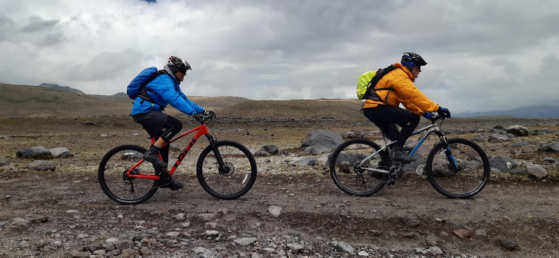
In Ecuador angekommen haben wir am 2. Tag unsere Räder ausgepackt und los gings mit dem Training nach drei Monaten “Radl Abstinenz “😯. Also trainieren damit wir nach Quito,  der höchstgelegenen Hauptstadt der Welt, radeln können. Doch hier in Ecuador ist gerade Regenzeit und wir wollen ja auch nicht ewig hier bleiben, deshalb haben wir uns kurzer Hand entschlossen, das Training unterwegs zu machen.😥🙄  Sind ja nur knapp 400 km und die paar Höhenmeter. 

Am 1. Tag waren es gerade mal 48 km und 200 Höhenmeter, nachdem wir einen Nachbarn als Wassertaxi bestellt hatten. Wir radelten im Nieselregen los und es blieb auch den ganzen Tag so.🌨🌨🌨

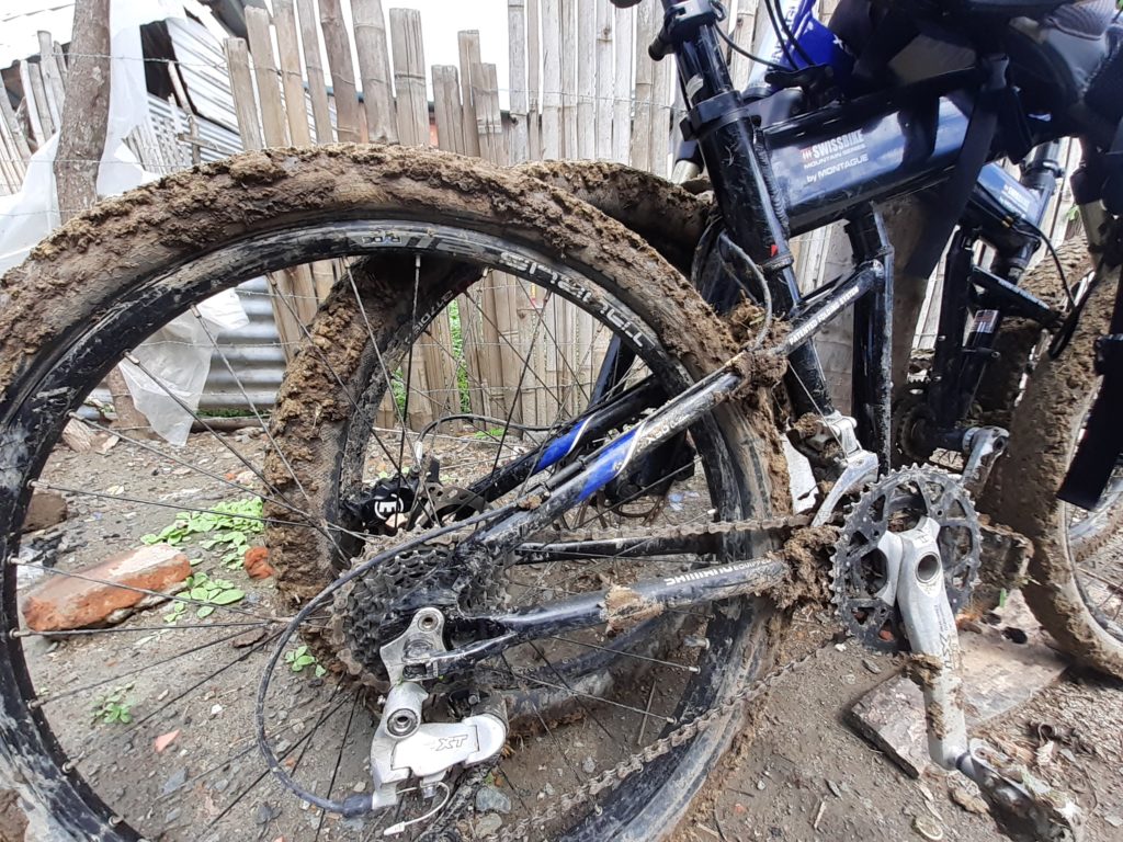
Am 2. Tag 50 km und 600 Höhenmeter auch kein Problem doch hatten wir eine Abkürzung gewählt,  die uns zwar 15 km spart aber “off road” war. 🙄🙄1,2 km Matsch, Dreck und überhaupt keine Straße – kein Rad drehte sich mehr und wir waren total am Arsch.😠😠

Kurze Abkürzung

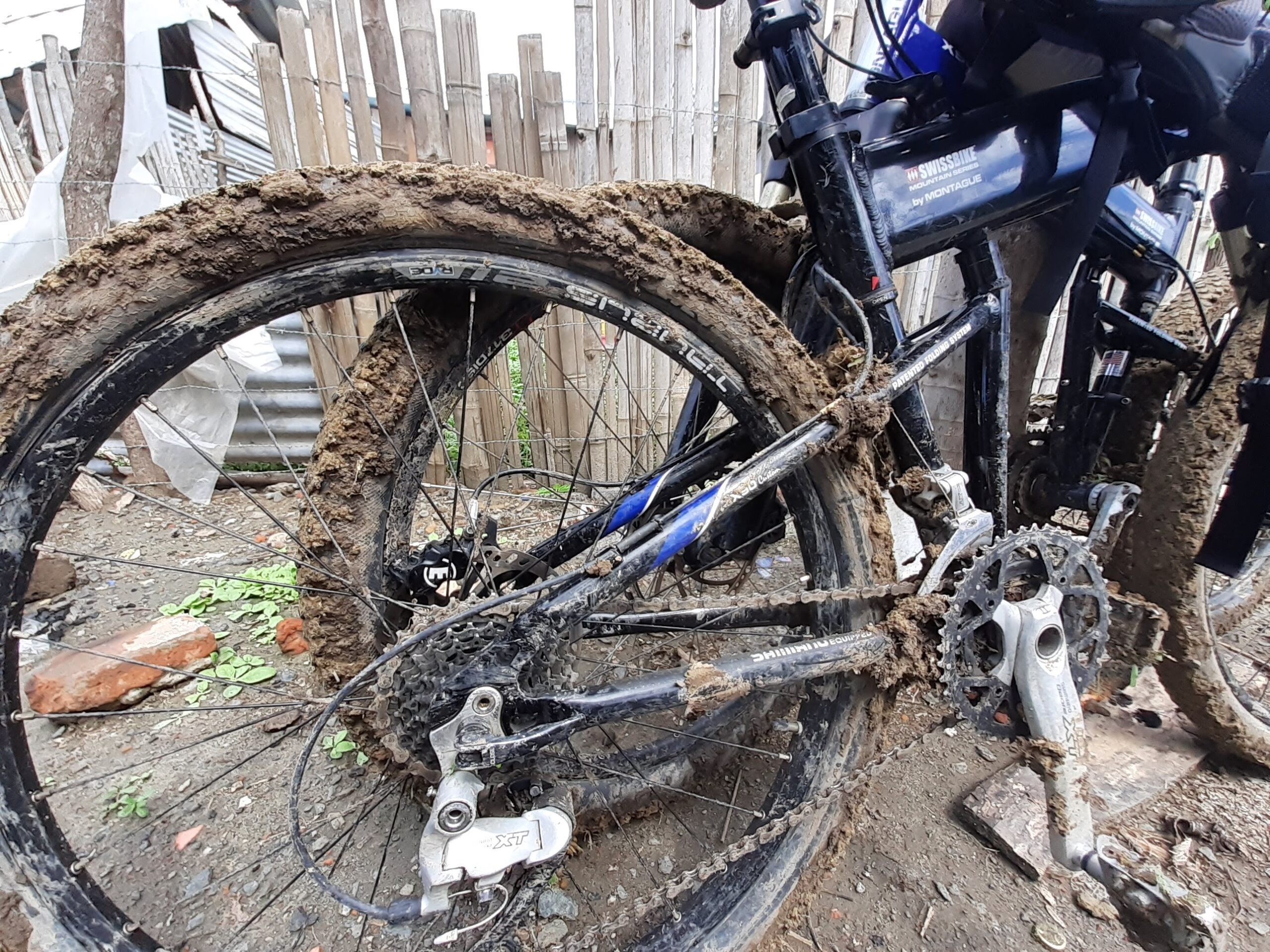
Dann haben wir notdürftig die Räder geputzt – soweit dass wir wenigstens wieder radeln konnten  – und weiter geht’s, im strömenden Regen. ⛈⛈⛈ Der einzige Vorteil unsere Räder waren dann fast sauber und wir haben uns fest vorgenommen die off road Strecken in Ecuador zu vermeiden 😁.

3. Tag 69 km und 1070 Höhenmeter und alles Teer  – sau cool und ziemlich trocken. 🌞🌞Quito wir kommen. Als Unterkunft haben wir nur ein Motel gefunden, dass nur  “Stundenweise” vermietet aber es war sauber, unbegrenzt warmes Wasser und etwas zu essen konnten wir auch bestellen; bloß a bissel viel rot und a bissl viel Spiegel. 🤗🤭😀

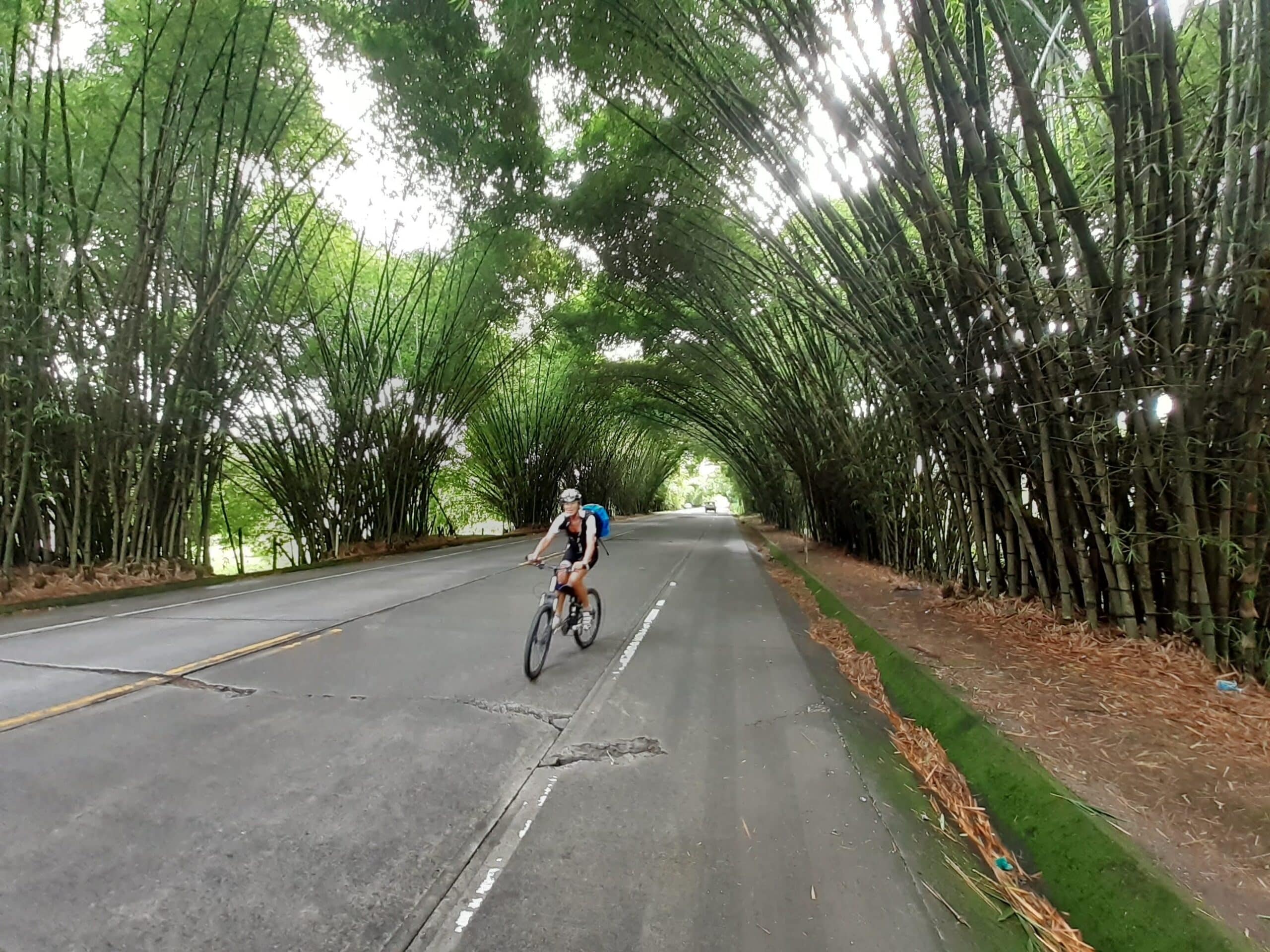
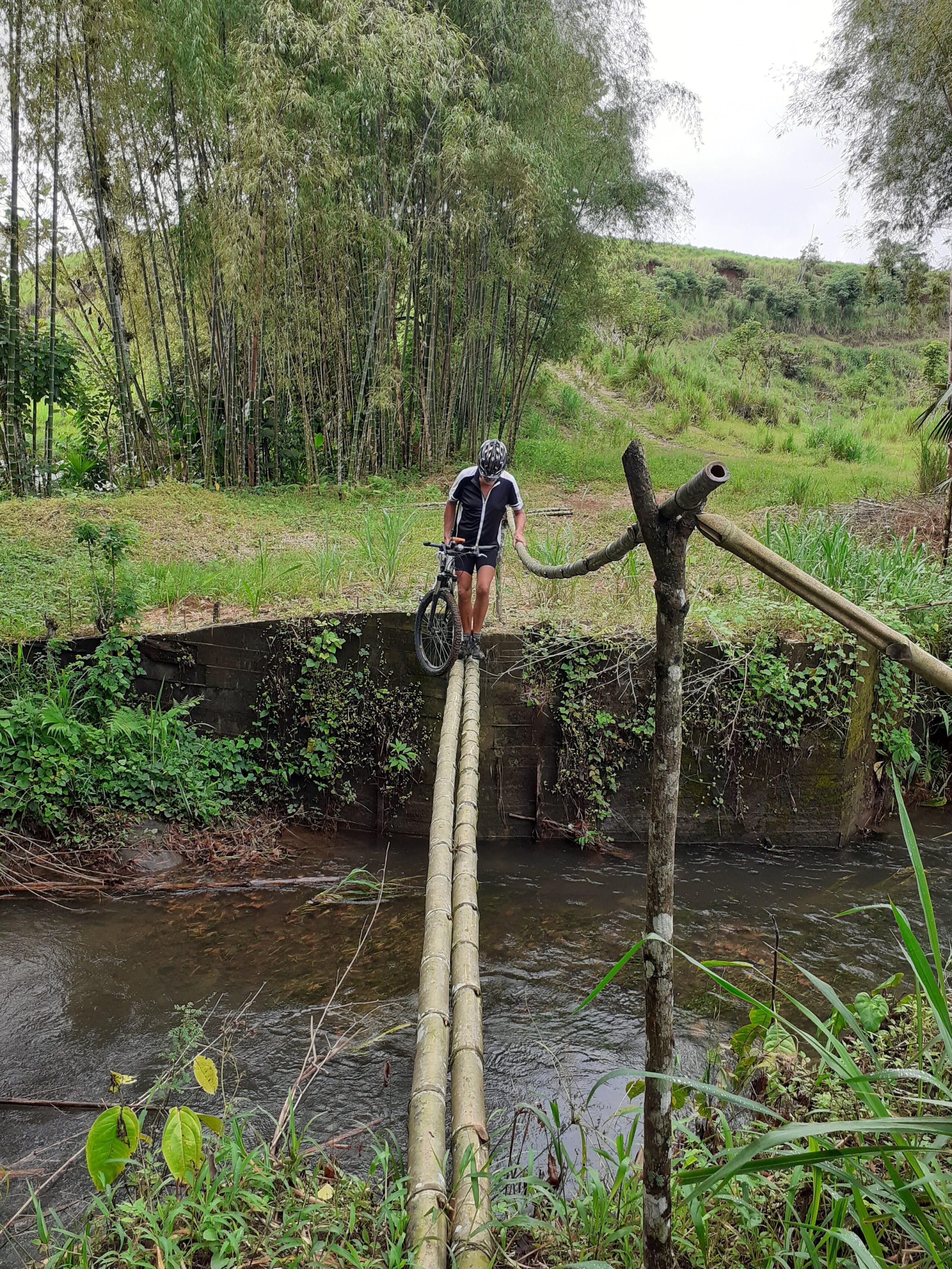
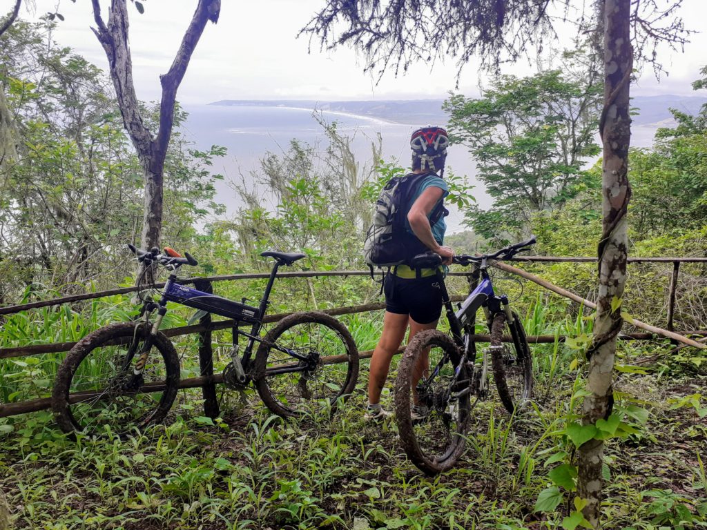
4. Tag 47 km und 804 Höhenmeter – hab ich etwa gesagt dass wir nur Teer fahren wollen. Nein total falsch verstanden  – hier war “Countryside” angesagt. 😁😁 Flußüberquererungen auf Bambus Brücken und Berg auf und ab.

Sichere Bambus Brücke

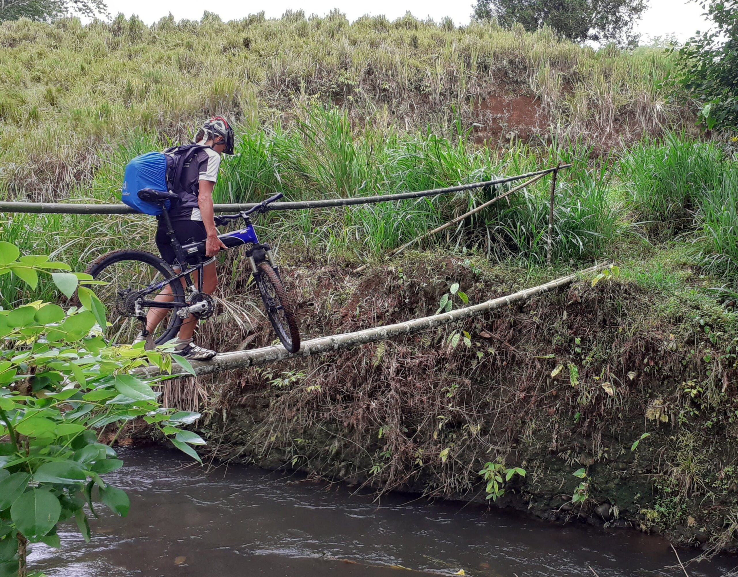
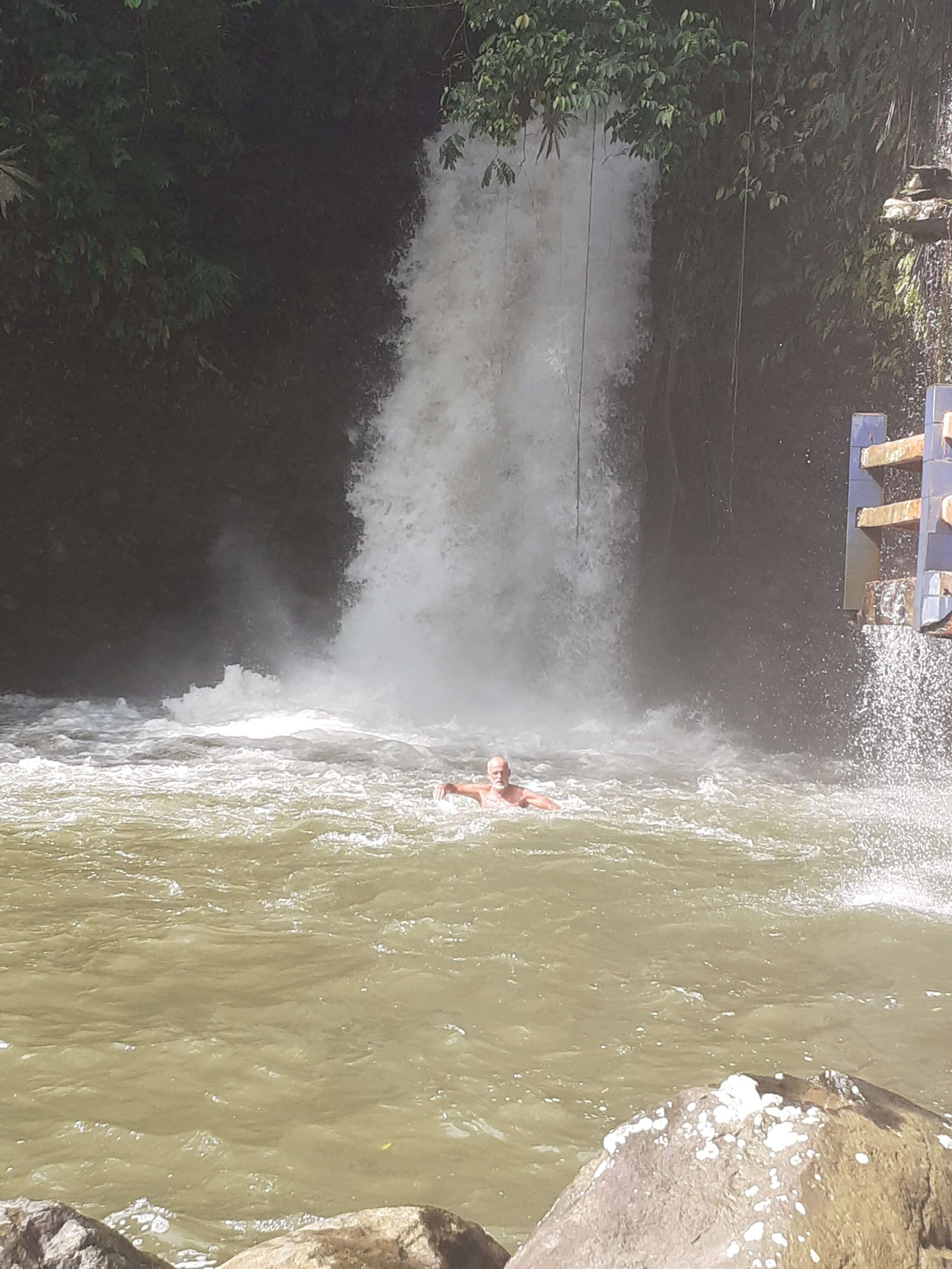
Ich sag euch nichts für schwache Nerven, aber es hat trotzdem riesig Spaß gemacht. Zur Belohnung haben wir uns heute ein richtiges Hotel gegönnt  – vom Feinsten – aber auch das einzige in der Gegend😊😊. Und gerade rechtzeitig, denn es regnet wieder in Strömen⛈⛈⛈. Aber nach einem fantastischen Abendessen und ausgiebigen Duschen waren wir wieder mit der Welt versöhnt.

5. Tag 68 km 1703 Höhenmeter nach einem ausgiebigen Frühstück machten wir uns trocken auf den Weg doch schon um 11 Uhr waren wir Patsche nass ⛈⛈und stellten uns unter und genossen einen heißen Kaffee.

Hier haben wir uns vom Regen versteckt

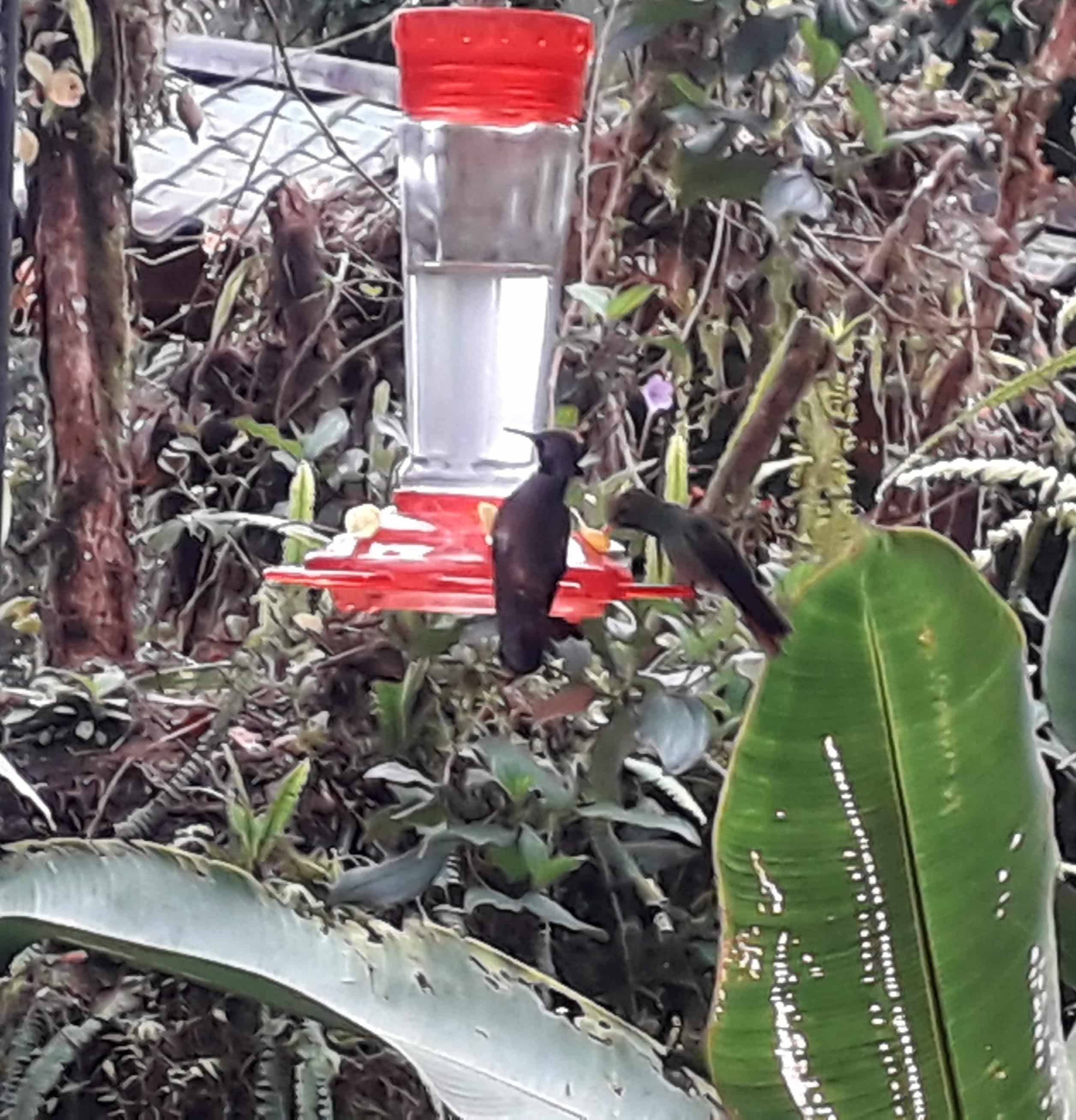
Gestärkt radelten wir weiter und kaum zu glauben der Wettergott hatte ein Einsehen mit uns und es blieb beim nieseln aber bei 1600 Meter Meereshöhe wird es dann schon fast a bissel frisch. Doch wir fanden wieder ein Hotel wo wir uns aufwärmen und ausschlafen konnten.😊😊 Hier waren viele Vogelbeobachter unterwegs und eine Amerikanerin erzählte uns, dass sie bereits Tukane und vieles mehr gesehen haben. 

Kolibris

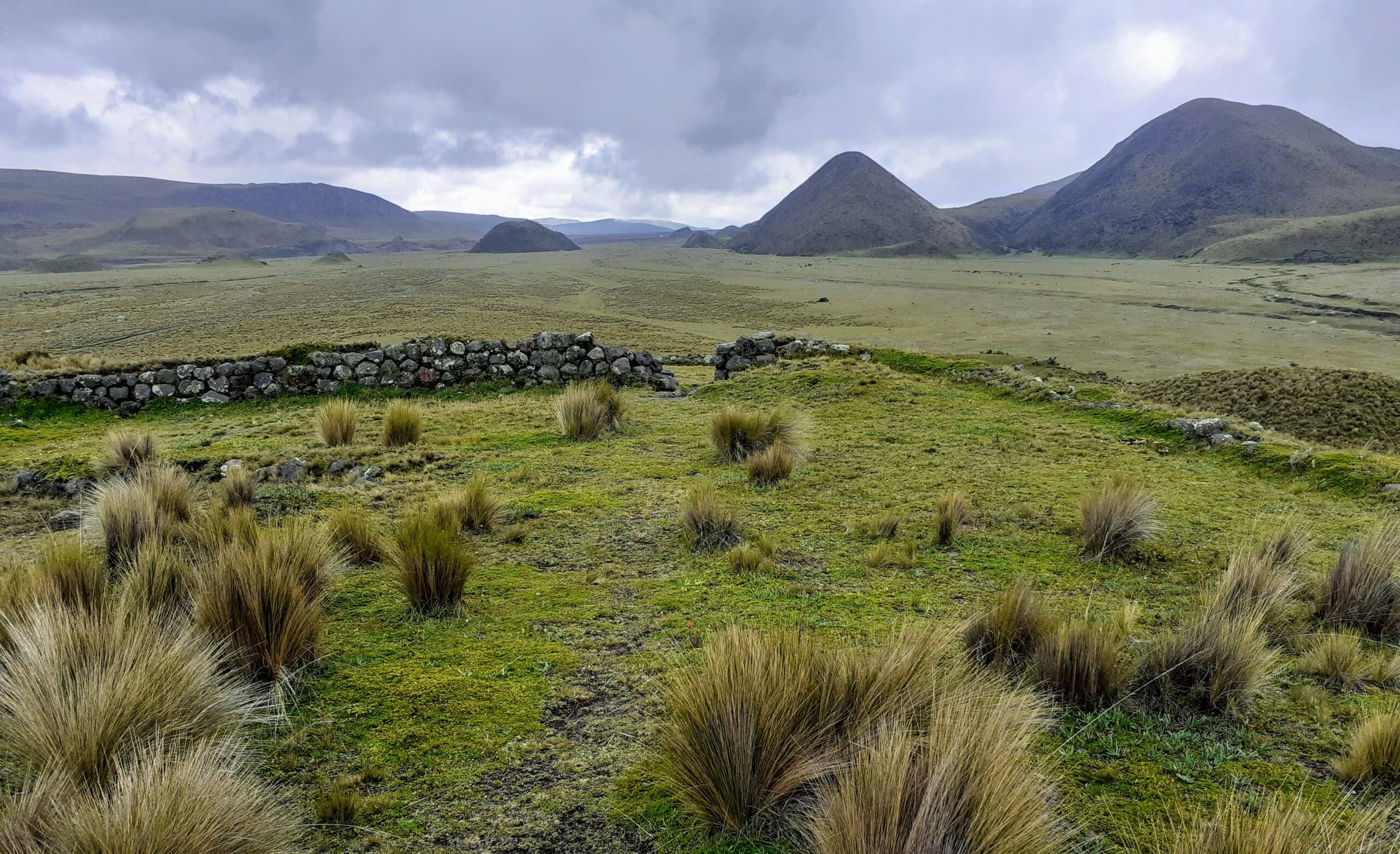
6. Tag 57 km 1912 Höhenmeter und wir haben es nicht ganz nach Quito geschafft aber immerhin sind wir bei 2700 Meter über dem Meer angekommen und das alles off road. Vom Hotel aus starteten wir bei 1700 Meter Meereshöhe und nach  27 km und 500 Höhenmetern waren wir gerade mal 100 Meter Meereshöhe höher und dann begann erst der Schotterpass. Wir kamen uns vor wie auf der Autobahn denn Lastwagen, Busse, Autos und Motorräder waren überall. Wie wir am Abend erfahren haben, war die Hauptstraße nach Quito wegen eines Erdrutsches gesperrt und deshalb war hier ca. 1 Stunde lang der Teufel los.😰😰😰 Ihr könnt es euch ungefähr so vorstellen als wenn der Verkehr der A7 auf die Straße nach Maria Trost umgeleitet wird. 🤔

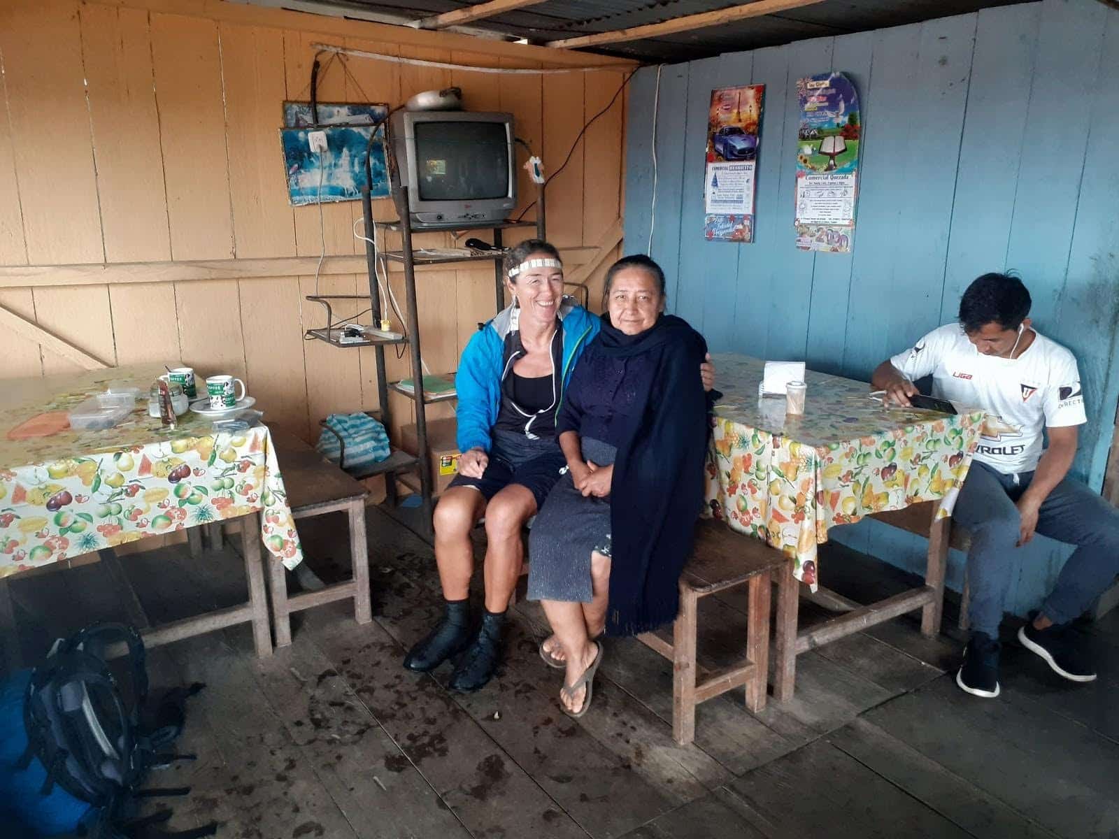
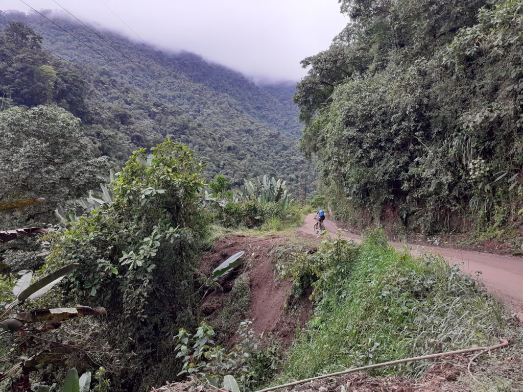
So gegen 14 Uhr erreichten wir eine Fischfarm mit Restaurant, wo viele Einheimische Fasching feierten 🤡🤡 und aßen.  Eigentlich wollten wir auch etwas essen, doch alles war mega voll und es gab nur ganze Fische – so überhaupt gar nix für meinen Neill🤪. Als wir versuchten zu erfragen wie lange es bis zur nächsten Einkehrmöglichkeit ist, bekamen bzw. verstanden wir 8 km. 😉Okay dass ist machbar also weiter geht es. 👍 Mittlerweile hatte es auch zu regnen angefangen 🌨 aber für 8 km kein Problem. Nach gefühlten 15 km fragten wir wieder, wie weit denn noch und bekamen wieder zur Antwort 8 km😰. Lange Rede kurzer Sinn nach ca. 3 Stunden Dauerregen ohne Restaurant nass, kalt und schon leicht ausgekühlt erreichten wir Nono – doch diesem Ort widme ich einen eigenen Blog. 😊😊

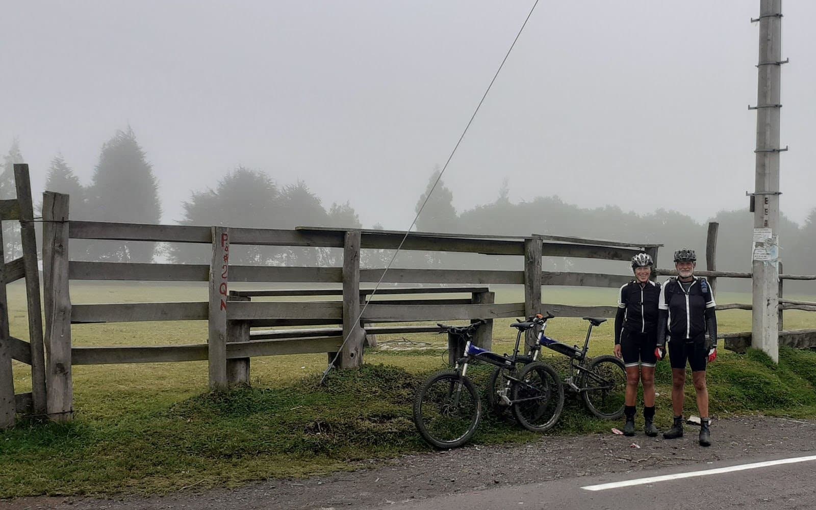
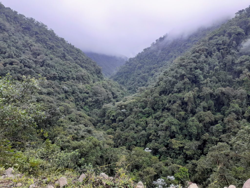
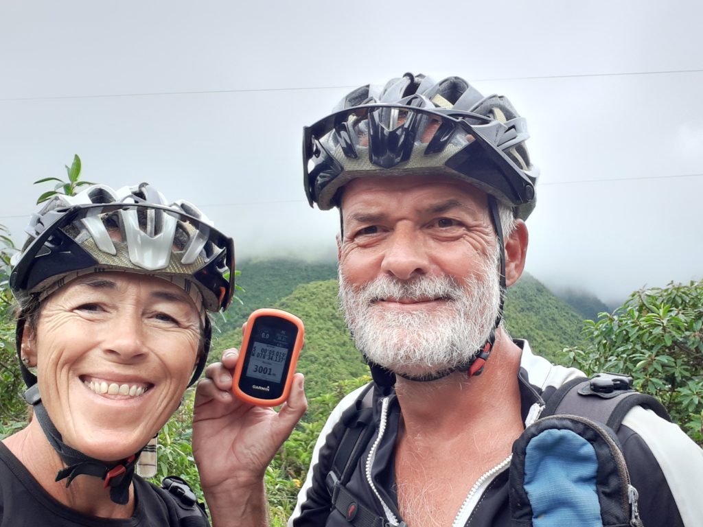
7. Tag nur noch 29 km und 700 Höhenmeter bis nach Quito und die haben wir total genossen 😊😊. Auf einer ruhigen Passstraße erreichten  wir den höchsten Punkt bei 3340 Meter über dem Meer. 

3340 Meter über dem Meer

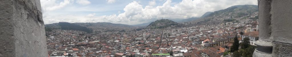
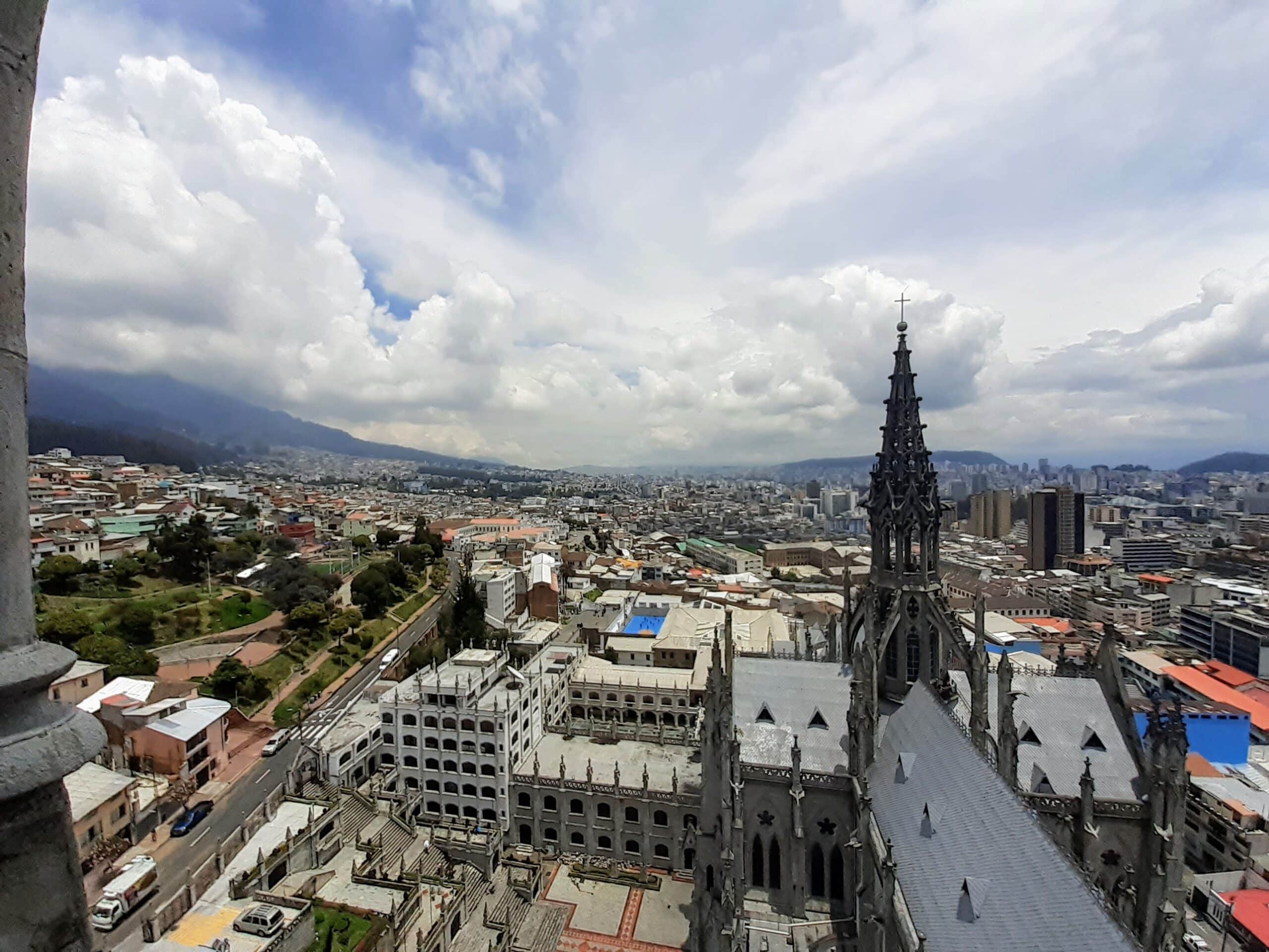
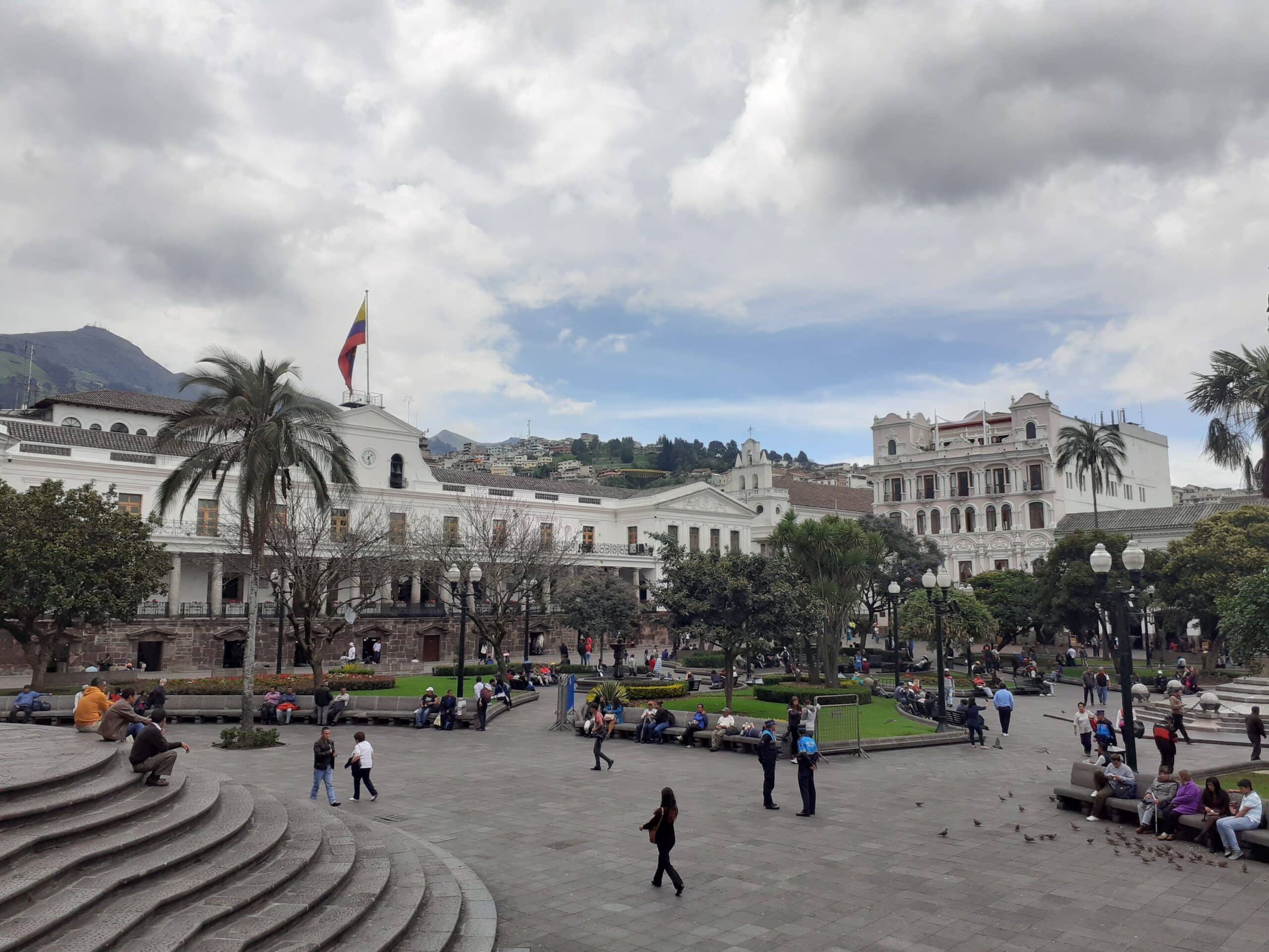
Nach 7000 Höhenmetern und 368 km Fahrstrecke erreichten wir glückselig Quito die höchstgelegene Hauptstadt der Welt.

Und wer unsere Radtour anschauen will, hier ist der Track.

Quito. Another days training.

I am not a great fan of cities and particularly city sightseeing but today we “did” Quito (highest capital in the world) and it was brilliant fun.

We took a taxi to the cathedral and looked around inside and out. It was “cathedrally” and huge and maybe worth the two dollars entrance fee. Then we went round the corner, paid another two dollars each and climbed the towers. Wow! Over one hundred meters of steps took us to the top and breathtaking views across the city and to the surrounding mountains.

The view from the cathedral tower

Notre Dame has Quasimodo in the belfry. Quito has Lenin. Lenin Pat Borhorquez runs the restaurant near the top of the tower. He is an accomplished linguist who effortlessly switched between Spanish, English and German. We spent an hour in conversation with him, all the time with the city far far below.

We wandered through town until we spotted a long flight of steps heading up the mountain to a huge winged statue. As soon as I saw the steps I knew this was a “Heidi sort of thing”. 945 steps and over 200 meters of climbing later we reached the top.

The Old Town

Some time during the first century Saint John went off on some mind altering trip. He must have been very very “infected with the spirit” and afterwards he wrote the last chapter of the bible – Revelations. By Chapter 12 he has the Virgin Mary wearing the wings of an eagle and fighting a dragon. In the 1970s the Ecuadorians built a 41 meter high statue of winged Mary atop the chained dragon on this 3000 meter high hill. Amazing!

Next we met a real person who was just as amazing. Jan is the founder and owner of Biking Dutchman, the company who we cycled Cotopaxi with yesterday. We enjoyed his life story over a coffee. People think we are crazy but Jan leaves us standing. Failing to get deported from Australia, sailing in front of a military fleet and couriering gold for the Chinese mafia – we want to buy a signed copy of his autobiography.

Equality in Quito

Nono. Paradise above the rain forest

Quito is a huge sprawling city high in the Andes; a massive urban sprawl that smothers the valley floor. But just over the mountains and less than twenty kilometers away is the tiny, peaceful village of Nono.

We reached Nono cycling up a long steep valley through the rain forest. This is Ecuador and it is the rainy season so everything looked succulent and green. We, after six days cycling, were wet, dirty, cold and tired. It was less than an hour until sunset when we rode in to town and everything was closed. We were not as happy as we had been.

Nono Main Street

We used our best Spanish to ask a young lady where there was a hotel. She knocked on the door of the restaurant “Tierras del Fuego” and Marcelo appeared. He smiled, told us to give him five minutes and got on his mobile. He then collected his dogs and walked us to his father’s house where he made us coffee and showed us to the most amazing holiday flat.

Villa Doris is a stunning apartment with beautiful details, a gorgeous garden and a log burning stove. The only sound is the neighbouring stream. Definitely the best overnight we spent in Ecuador. The owner, Lorena, drove us back to the restaurant and, despite being closed, Marcelo created a dream meal which left no doubt about his international expertise as a chef. It was accompanied by a lovely wine from Patagonia.

Dinner for two

Lorena drove us back “home” where the log fire was burning and she had collected and dried all our wet clothes. We were in paradise.

The breakfast looked too good to eat but we ate it anyway. Fresh local fruit, fresh local baked breads and coffee. All with a view of the humming birds in the garden. Lorena knows how to fuel and motivate cyclists for the rest of the climb to Quito.

Our last view of Nono was from a curve on the pass. Small houses huddled amongst green fields surrounded by the imposing Andes. Beautiful!

The Cotopaxi Project

In Panama Heidi was ill and tired from just the journey from bed to toilet and back. I was reading about Ecuador and specifically about the volcano Cotopaxi. The internet mentioned that you could cycle down from 4600 meters above sea level. I was excited. Heidi was totally disinterested.

At about 4300 meters above sea level the air is thin. You don’t cycle and talk at the same time.

But then she recovered and mentioned that it sounded like fun. So we left Panama and sailed south for eight days to Bahia de Caraquez. There we put the bikes together, did some rudimentary training and cycled nearly 400 kilometers from the Pacific to the Andes. The trip took seven days and we climbed 7000 meters before reaching Quito.

On the eighth day we joined five other mountain bikers on a tour organized by the Biking Dutchman. We drove up the side of the volcano to the car park at 4600 meters. Here it was freezing and we put on every item of clothing we had with us before beginning the descent. Luckily all seven members of the group were mountain bikers – a pair from New Zealand cycled across the Himalayas and another girl cycles amateur races in the USA. As a result the descents were very fast and huge fun. The whole route was flowy and technically easy and left huge grins on all our faces.

We cycled past wild horses, wild cattle and Llamas. We saw a condor in the distance soaring above the bare, Tolkien like landscape. We visited a spring where a stream exits the side of the volcano and a pre-Inca hill fort. The route was mostly downhill but the few uphill sections immediately reminded us that we were still well above 3500 meters.

View from the pre-inca fort. You wait for Tokien’s Orcs to attack.

Cotopaxi itself only briefly peeped out of the clouds but that could not detract from a fantastically enjoyable ride in a stunning landscape with a group of fun people.

The GPS was hidden in the rucsac and lost signal a few times but the track is at alltrails.com

Up in to the Andes

The last two days of our trip to Quito were where we hit the Andes and the going got tough.

We left our bird lodge after a long sleep and filling breakfast. We cycled up and down hills for the first 27 kilometers and climbed six hundred meters. Then we turned off up a dirt track and began the real days work. 1400 meters of climbing up thirty kilometers of the “old pass”.

Land slides abound

The road was stony, muddy, wet and slippy. In a few places parts had slipped away in to the valley below and in a few other places it was like cycling in a stream. Progress was slow and by two in the afternoon we were looking for food and accommodation. “No problem” a local told us. “Just go to Nono. Seven or eight kilometers.” After eight kilometers we asked the next local – “Not far. Eight kilometers maximum.” By now it was really wet and sunset was getting closer. The next local promised “30 minutes or so”.

Eventually we found Nono and knocked on the door of a closed restaurant. Marcelo came out, smiled at us and organized beautiful accommodation and amazing food. The day was a success.

On our last day we only had 29 kilometers and 700 meters of climbing and for the first time reached our destination dry. We cycled up through the cloud to the top of the pass at 3340 meters. From there the only route was down to Quito – at 2900 meters the highest capital in the world – and through the city to finish at the office of Jan – the biking dutchman.

At 3000 meters and still climbing

A GPS recording of the complete trip is at alltrails.com. Ignore the huge spike at the beginning which is not true – it is a problem with the way alltrails deal with the data. We “only did” about eight or eleven thousand meters, depending on which program you use.

Seven days, nearly 400 kilometers and maybe 10000 meters of climbing. But we did it. We cycled from the Pacific to the Andes.

Feed the machine

At the end of our last blog we were in a motel which offered no breakfast so we left at seven after a few biscuits. Our route immediately turned off down a stony track which later became a path. We descended to a river and were faced with stripping off and fording it but then we noticed a bamboo bridge which we balanced across. Later we found an even more exciting bridge with two bamboo sticks to stand on and a very bendy handrail. But we negotiated it successfully.

Bridge with alibi hand rail

We were in the middle of nowhere and hungry so when we finally rode in to a town, we stopped at the first shop to buy fluids and bread. Then it was back in to the stunningly green countryside and extremely stony trails. By midday I was “only firing on three cylinders” and needed food. Luckily after crossing the Rio Blanco, we found a beautiful hotel facing a huge waterfall. The rest of Sunday was declared an afternoon off. Pinacolada, swimming, lieing in the sun and lazing around was ordered.

Outdoor shower

By the evening we were seriously hungry and each ate two main courses and almost took a second dessert. The body is quite happy to cycle to the Andes but it demands fuel.

On Day 5 we did it all correctly. Started the day with a big breakfast and then began the long uphill slog in to the mountains. By eleven we were soaking so hid in a coffee shop with warm mugs of milk coffee until the worst passed. At three we were at 1100 meters and had cycled 50 kilometers. The tank was once again empty but we found a restaurant to refill. More food; more drinks; and then we quickly polished off the final 20 kilometer climbing through the rain forest to spend the night in a lodge above 1700 meters.

Day 3 is always the worst

At least that is the way I remember cycling. But today is the third day and we enjoyed it.

After our “two training days” Heidi suggested we continue to train as we head towards the Andes. Sort of “getting fit on the job” concept. It sounded “adventurous” and adventure is what we do.

We had a neighbouring sailor pick us up in his dinghy and take us ashore to our bikes. It was drizzling when we woke and stayed that way all day. Just enough to keep us damp with the occasional periods of real rain. We left Bahia de Caraquez and followed the river up to Chone passing strings of shrimp farms. At lunch time we stopped at a restaurant to check the taste of the shrimps. We reached Chone and found a hotel just as it began really raining so arrived soaked through.

Green Ecuador in the rain

Day two we left the river and followed a local road heading in to the hills. The countryside was a hundreds of shades of green. The daily rain ensures that everything grows big, succulent and green. It also makes every track without tarmac a mud bath. I made the mistake of taking a 1.2km shortcut and we nearly disappeared in the mud. The bike wheels didn’t turn and the bikes were twice their normal weight. When we eventually reached a road we scraped mud off the bikes and off our shoes and then cycled further. A short while later it poured with rain for two hours so the bikes got cleaner.

The bike lane occasionally disappears due to earth slides or rock falls.

And today we stayed on the road all day. No shortcuts. No mud. The last two days we did fifty kilometers per day but today we needed to cycle seventy to reach the next town with hotels. And there was a pass to cross. We climbed 1070 meters.

Loads of cars sound their horn or flash their lights and show the thumbs up sign when they see us. The people ask where we are going and when we say “Quito” they stare at us and say “Frigo!” (cold!) Or they turn to their friends and say “they are going to Quito” and every one shakes their head.

We got soaked going up the pass but dried off on the way back down and during the lunch stop. Just before the rain started again we found a great hotel. They charge by the hour but we negotiated a price until seven tomorrow morning. Everything is decorated in red with hearts. But free wifi and endless hot water to wash clothes and bodies.

Bamboo tunnel

So now we have 170 kilometers behind us. The training program is running well. By the time we are finished, we will probably be fit.

Mountain biking again

Our mountain bikes have been neatly folded in their bags and hidden away in the quarter berth since our ride from Shelter Bay in Panama. It had been three months since we last used them and we were a little worried how our legs and bottoms were going to hold up.

The ride to the dinghy dock was the first time with bikes and new dinghy. It works great. Much more stable than the old dinghy where Heidi had to squat on the side. And, of course, there being no swell and no waves here makes it all so much more fun.

The first “get back in to the swing of it” tour was over a tiny (hundred meter high) pass to a beach on the Pacific coast. Only six kilometers to the sea. Easy! On the way back, we thought we would take the off-road track across the hill. This route was also only six kilometers but crossed a two hundred meter high ridge, had sections of up to 50% and was all mud. And through the jungle with lianas trying to grab your bike. It was “challenging” especially when both wheels are so full of mud that neither would turn.

Real Ecuador mud

When we eventually exited the forest we received a telling off from a lady because we had just descended through her private nature reserve. We apologized.

Pacific view. Just in front of Heidi is a cliff.

Just as we entered civilization, Heidi’s phone rang so we stopped. Neill scraped dirt off the bikes and drank beer given to him by the locals stood outside a bar. Later we discovered that this part of town is the “dangerous bit” but obviously we looked too filthy to be worth robbing.

The track is at https://www.alltrails.com/explore/recording/20200216-bahia-de-caraquez-74de5f9

The next trip was much more civilized. We cycled the forty kilometers to the seaside resort of Canoa. The route was almost entirely on a cycle path and the only hill climbing was across the long bridge which took us across the estuary. Neill got a puncture – our first in Ecuador.

In Canoa we found a restaurant for lunch and chatted to the locals on the neighboring table. He emigrated to the USA long ago but the two ladies were from Bahia. All were amazed to hear about our adventures and warned us that when we go further inland it is “freezing”.

Biking done. Showering done. So now a drink looking at the lights of Bahia de Caraquez

The track is at https://www.alltrails.com/explore/recording/20200218-ecuador-seaside-ride-21be992

So now the training is finished. Tomorrow we plan on setting off for Quito. Four hundred kilometers and four thousand meters of climbing. I hope my cycling shoes last that long; the muddy jungle was not kind to them.

Power generation upgrade

Warning! Technical article. Lots of data and numbers and not funny.

Last year we wrote about our regenerative electricity production and about our Aquair towed generator which we use as a second wind generator. As long as the wind blew everything was working perfectly but when it stopped (as in Columbia) then we realized that our batteries were no longer working properly and the solar was under-dimensioned especially with our water maker now running. There were even a few days that we had to run the engine and that is awful.

So, while in Panama, we rebuilt and rewired things again.


The HRDi controller from Marlec regulates the power from the wind generator and can optionally work as a controller for 160 Watts of solar panels. It works but lacks an absorption phase during the charging which is not good for the batteries. Additionally only 12V modules can be connected which is not enough to allow the MPPT (max. power point tracking) to function efficiently early and late in the day or when the sky is overcast. We bought a Victron Energy SmartSolar 30/100 which has a three phase charging algorithm and can deal with a higher voltage. Really nice is the Bluetooth connection which allows us to see the actual and historical data on the smartphone.

the blue line in this screenshot from our data logger on 5. Feb. shows the controller working perfectly. Bulk, absorption and float. (All times are UTC and we are UTC+5 so sunrise is about twelve.)

We doubled our solar power by buying two new 80 Watt panels from a Chinese electrical store. With four panels rated at a total of 320 Watts, we could connect two strings of two panels and thus double the voltage available to the controller.  All four panels are mounted and wired above the cockpit and nicely hidden from below by the bikini sun cover.

Our batteries were sourced by Ardfern Yacht Center two years ago and, according to the manufacturer, were unsuited for use in a regenerative energy system. They were not deep cycle batteries and were not helped by the few times we ran them nearly empty. The lack of an absorption charge phase in the controller also shortened their life. We bought three deep cycle marine batteries – two for the services and one just to start the engine – manufactured by East Penn. They have a great document that describes which charging voltages to use and a competent and quick customer support who actually answer emails and wrote that we should use a float voltage of 13.8V and absorption of 14.7V.

Information_Sign
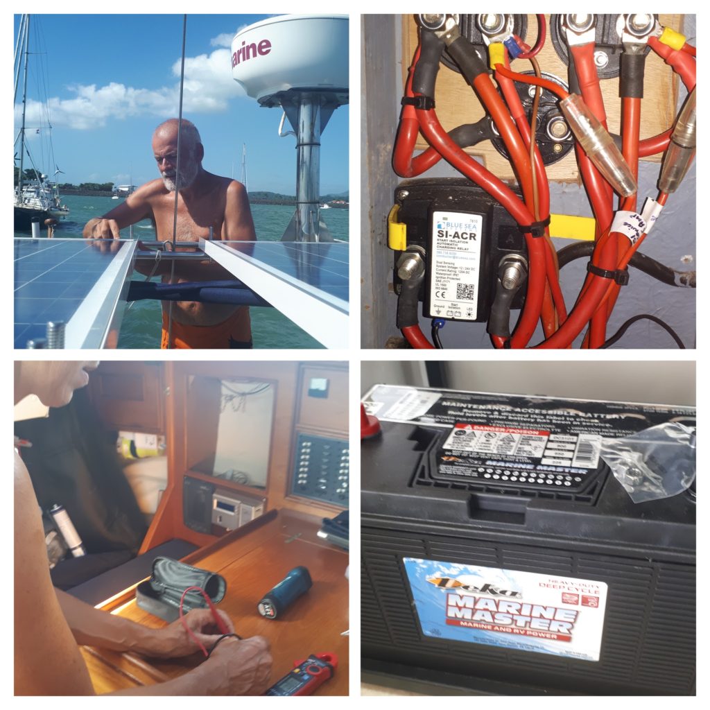
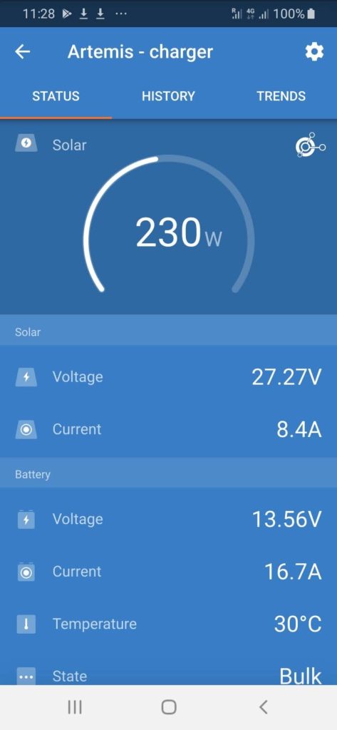
The batteries are Deka DC31DT Marine Master manufactured by East Penn. Their data sheet for regenerative systems is online here. Gabriel Schneck is their great customer support person who helped us.

In Panama the system worked well despite us being anchored facing north and thus with shadow on the panels. Sailing south to Ecuador we produced 1400Wh of solar power one day and the next day – with absolutely no sun – 360Wh but our average after 33 days is about 700Wh. Each wind generator produces an average per day of about 200Wh and when on passage the towed generator produces between 150 and 800Wh depending on our speed.

Screenshot from Android App. Per Bluetooth we can see what is happening in the system. In real time and as a daily summary.

The first month suggests that we are now self sufficient in electricity and therefore also water production. Another piece of freedom.

ITCZ aka. The Doldrums

When you learn to sail with the RYA, there comes a point in the theory where you learn about the Intertropical Convergence Zones. These are found at the Equator and, studying in far off Germany, they feel about as relevant as treatment for polar bear bites.

But then one day you sail south and, sooner or later, they become very real. For us that moment arrived as we waited to leave Panama heading for Ecuador.

the light blue shows the ITCZ that we had to cross. (Mats Halldin [Public domain])

The ITCZ is also known as the Doldrums. It is the area where the northern weather meets the southern weather and, as they don’t mix, are characterised by calm or squalls, rain and cloud. They spread from West to East across the oceans apparently baring the way to sailing vessels. “The Book” suggests that you just take lots of diesel and when you find yourself becalmed turn south and turn the engine on. Friends did just that last week and motored for thirty six hours non-stop.

Information_Sign“The Book” is Cornells Ocean Atlas and the accompanying World Cruising Routes, both by Jimmy Cornell. They have diagrams explaining the average weather in each month and descriptions of the best time and tactics to sail the various routes.

But we are sailors and we barely carry enough fuel for thirty six hours of motoring. We had a different plan. We waited for a strong period of north wind and let that carry us as far south as it would. In February (on average) there is a “gap” that opens off the coast of Columbia and Ecuador which we aimed to squeeze through. 

The Parasailor effect. Speed dropped to under three knots and sail flogging. Hoisted Parasailor and moving twice as fast.

And it almost worked. We averaged over five knots for three days before eventually running out of wind while still two and a half degrees north of the Equator. Luckily we have a Parasailor so we flew that and it kept us moving (barely) for another fifty miles. Just before dawn we hit the promised deluge. No wind, choppy seas and buckets of water. Perfect conditions to go up on the foredeck and strike the Parasailor.

We bobbed around with just the jib up and drifted back North. Eventually we felt the hint of a wind and managed to turn the sluggish boat and move at about one knot heading south east. Sometimes we nearly managed two knots hand steering through the gloom in the downpour.

After a few hours we picked up the winds of the South Pacific and the rain stopped. As we sailed south the wind speed increased and with full sails we headed for Ecuador. It looked like we had found the secret doorway to the South.

Parasailing to Ecuador

While friends further out in the ocean battled a southerly gale we enjoyed sailing hard on a south westerly wind which took us straight to Ecuador – unfortunately a little too far north so we could practice our tacking.

We finally reached the entrance to the river at midday on the sixth day. We crossed the equator the previous night so were now showing degrees south on the GPS. We had to wait until one hour before high tide to follow a harbour pilot across the bar and even with him leading it was interesting as we surfed big swell towards the town wall. 

Heidi in contact with our pilot via sign language. She can sign fluently in Spanish.

And then, after six and a half days, we sat in the cockpit and looked at the Ecuadorian town of Bahia de Caraquez around us.